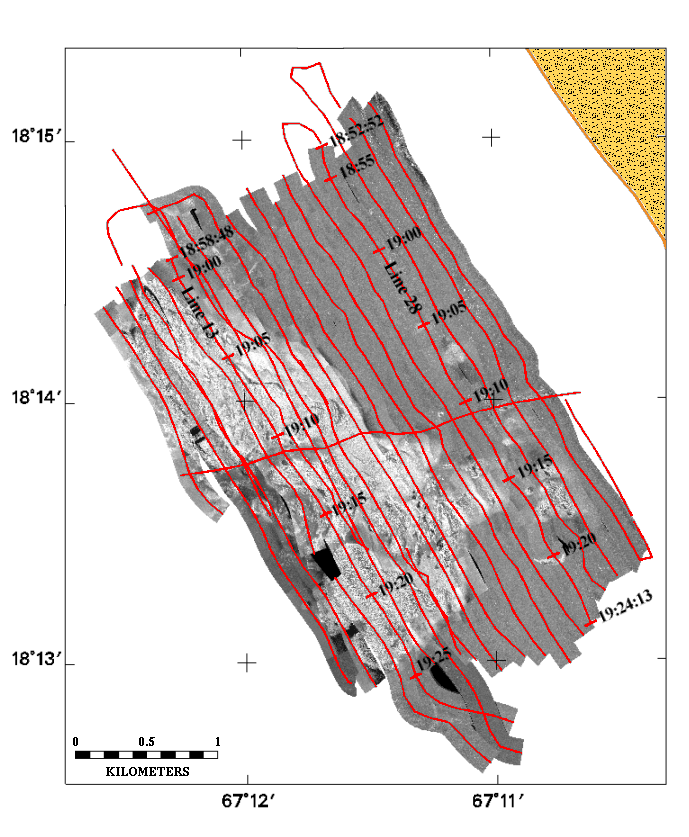
Figure 3. Map showing ship tracklines used to collect sidescan-sonar and seismic data. Lines 13 and 28 are the location of the seismic profiles used in Figures 7 and 8 respectively.
Return to document.