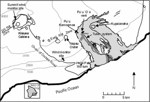
Figure 1. Summit and rift zones of Kilauea Volcano. From 1979 to 1997, most of the SO2 at Kilauea was released from the summit and east rift zone. Vehicle-based COSPEC measurements were made in the summit caldera and along Chain of Craters Road during trade wind conditions, to quantify summit and east rift zone emissions respectively. Intermittent airborne and tripod-based surveys made near Pu‘u ‘Ō‘ō, augmented the vehicle-based studies.