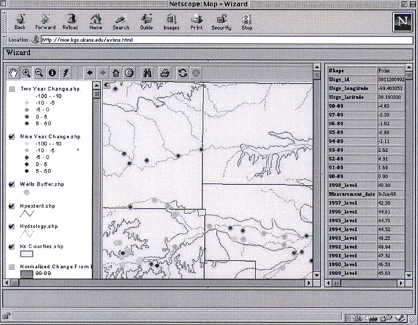
Figure 3. Walnut Creek and Pawnee River valleys, with data table displayed for a queried well. |
RETURN TO Providing Spatial Data and GIS Applications Via the Internet
U.S.Department of the Interior, U.S. Geological Survey
<https://pubs.usgs.gov/openfile/of98-487/ross1-2.html>
Maintained by Dave Soller
Last updated 10.06.98