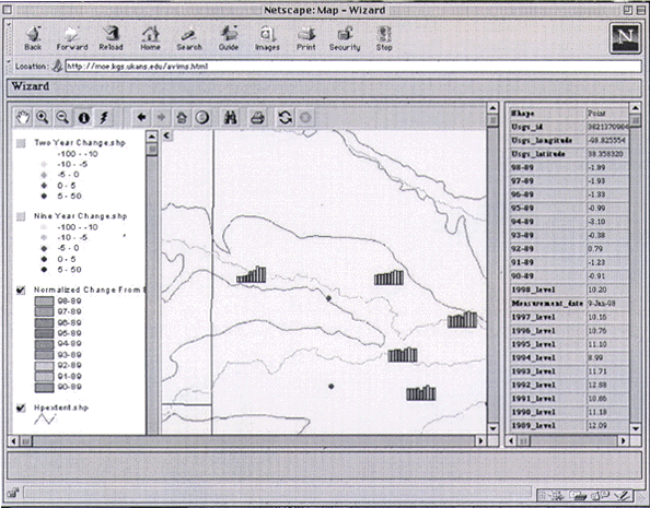
Figure 4. Graphic display of depth to water, measured over ten years, for wells near Great Bend, KS. |
RETURN TO Providing Spatial Data and GIS Applications Via the Internet
U.S.Department of the Interior, U.S. Geological Survey
<https://pubs.usgs.gov/openfile/of98-487/ross1-3.html>
Maintained by Dave Soller
Last updated 10.06.98