|
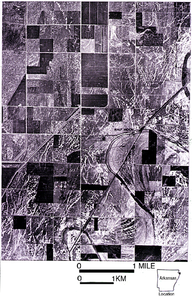
27. This slide and slide 29 following are aerial photographs of the New Madrid region. The purpose of
these slides is to show the association of liquefaction features with the mechanism of ground failure.
Distance across the photograph of this slide is about 3.5 miles (6 km). Note two types of features in this photograph: long, linear (white) features and isolated (white) spots. The linear features are dikes caused by lateral spreading. They have formed in proximity to and parallel to topographic depressions (valleys of small streams) and that they are most abundant near the depressions (generally within 1 to 2 km), This distance of 1 to 2 km is relatively far for lateral spreading from strong earthquakes worldwide but not in the New Madrid region. The large distance for the 1811-1812 earthquakes is likely explained because the triggering earthquakes were extremely strong (M likely >8) and the seismic parameter of stress drop was probably high, a combination that induces exceptionally severe shaking. |
For more information, contact Stephen F. Obermeier