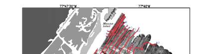
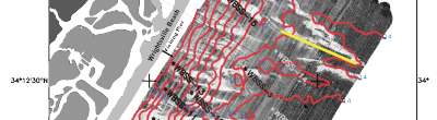
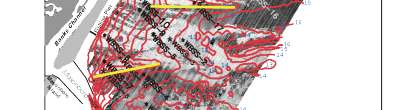
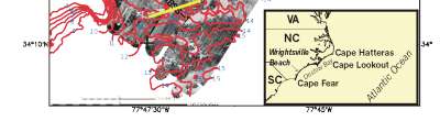
Sidescan-Sonar Imagery of the Shoreface and Inner Continental Shelf, Wrightsville Beach, North Carolina
Figure 1. Sidescan sonar mosaic of the Wrightsville Beach shoreface and inner shelf, showing depth contours, surface grap sample locations, and low-relief ridge axes.
Click on image to zoom in.
|