Multibeam Bathymetric and Backscatter Maps of the Upper Hudson Shelf Valley and Adjacent Shelf, Offshore of New York
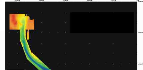
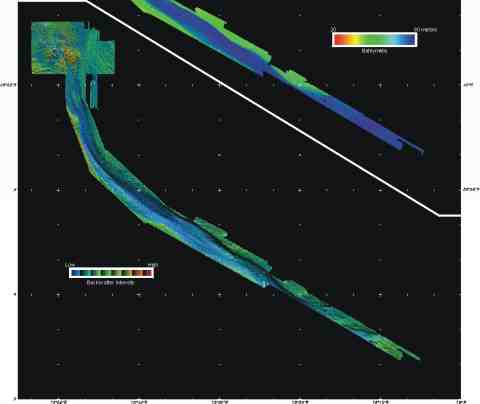
Figure 4. Bathymetry of Hudson Shelf Valley as measured in the multibeam survey. The color-coded image shows deeper regions in blues, shallow in reds. The lower images shows the sediment backscatter intensify draped over the shaded bathymetric relief, as in Fig. 3. This image was created by vertically exaggerating the bathymetry (in this case 4 times), artificially shading the relief (in this case by illumination from 350(at an elevation of 45(), and then draping the color coded backscatter intensify over the bathymetry. Within each backscatter color (red is high backscatter, blue is low backscatter), the intensity varies from dark to light depending on the illumination. High backscatter generally indicates a hard seafloor, such as rock or coarse-grained sediments, weak backscatter indicates a soft sea floor, such as fine-grained mud. The axis of the valley is floored with fine-grained sediments. A survey planned for the fall of 1998 will expand coverage down the valley and onto the adjacent shelf.
Click upper or lower portion of figure to zoom in.
Click upper or lower portion of figure to zoom in.
 |
 |