Multibeam Bathymetric and Backscatter Maps of the Upper Hudson Shelf Valley and Adjacent Shelf, Offshore of New York
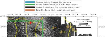
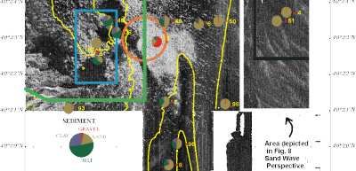
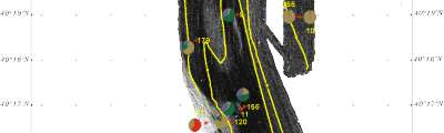
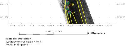
Figure 6. Map showing backscatter intensity, bathymetry contoured at 10 m intervals, locations of sediment samples, and surficial sediment texture (as pie diagrams). The boundaries of the Mud Disposal Site and the Historic Area Remediation Site are also shown.
Click on figure to zoom in on pie diagrams
 |
 |
 |
 |