Multibeam Bathymetric and Backscatter Maps of the Upper Hudson Shelf Valley and Adjacent Shelf, Offshore of New York
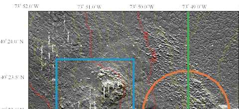
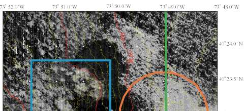
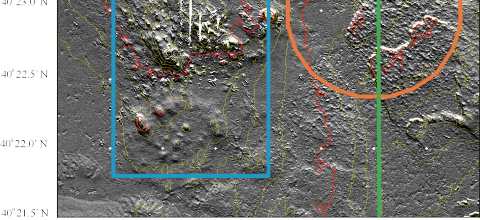
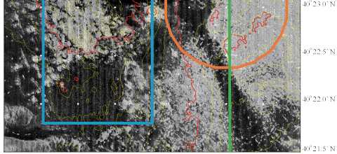
Figure 7. Shaded-relief bathymetric map with 2 m contours (left) and backscatter intensity (right) with the same 2 m bathymetric contours at a scale of 1:12.500 for the region surrounding the Dredged Material Disposal Site. Some of the regular parallel striping reflects poor data return at nadir (directly under the ship): other parallel striping is the result of differing reflection depending on the angle of incidence of the sound. The north-south white areas between swaths (at 40° 24' N and 73° 51.5' W and at 40°' 23' N between 73° 50.5' W) are data gaps between swaths where the width of the multibeam system narrowed over the shallow topography. In the shaded-relief image, the bathymetry was exaggerated 5 times and illuminated from an azimuth of 350° at an angle of 45°. The shaded-relief bathymetric map was created from the data gridded at 3 m and the backscatter intensity from data gridded at 2m.
 |
 |
 |
 |