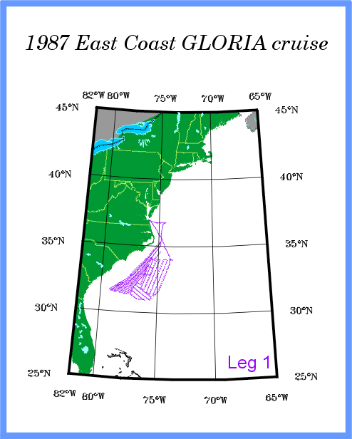
- R/V FARNELLA 87, Leg 1 - - - 2 - 27 February, 1987
- R/V FARNELLA 87, Leg 2 - - - 1 - 26 March, 1987
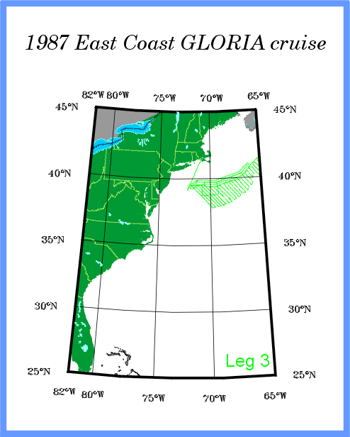
- R/V FARNELLA 87, Leg 3 - - - 28 March - 25 April, 1987
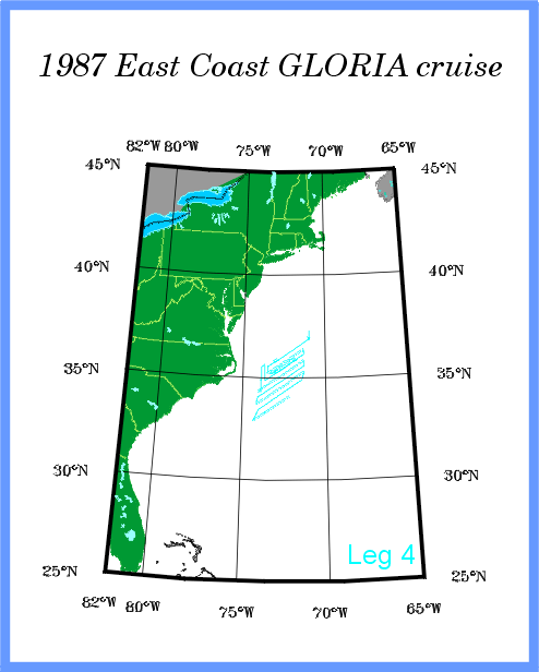
- R/V FARNELLA 87, Leg 4 - - - 27 April - 8 May, 1987
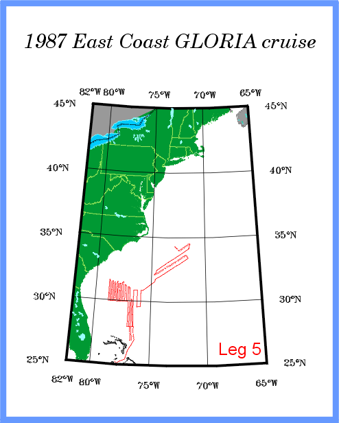
- R/V FARNELLA 87, Leg 5 - - - 9 - 28 May, 1987
GLORIA sidescan data ![]()
- 1987 Leg 1 data index
- 1987 Leg 2 data index
- 1987 Leg 3 data index
- 1987 Leg 4 data index
- 1987 Leg 5 data index
Navigation Data ![]()
- R/V FARNELLA 87, Leg 1 - - - 2 - 26 February, 1987 track map
- R/V FARNELLA 87, Leg 2 - - - 1 - 26 March, 1987 track map
- R/V FARNELLA 87, Leg 3 - - - 28 March - 24 April, 1987 track map
- R/V FARNELLA 87, Leg 4 - - - 28 April - 7 May, 1987 track map
- R/V FARNELLA 87, Leg 5 - - - 10 - 27 May, 1987 track map