

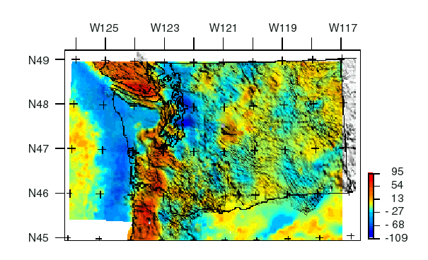
The colors on this map reflect variations in the Earth's gravity field caused primarily by lateral variations in density in the rocks that make up the upper part of the Earth's crust. This map is known as an isostatic gravity map and was derived from Bouguer and Free-Air anomaly maps ( Finn and others, 1984). The features and patterns of the maps reveals details of subsurface geology including the location of buried faults, sedimentary basins, plutons, uplifted oceanic rocks, etc. Positive anomalies (red colors) delineate rocks denser than the surrounding rocks. Negative anomalies (blue colors) delineate rocks less dense than the surrounding rocks. The gravity map is superimposed on the magnetic map (shading).
The gravity data are available from the National Geophysical Data Center (NGDC). HPGL plot files for the image can be downloaded (see download plots) for plotting at true scale of 1:1,000,000 for the overview map.