The Honeycomb Hills are two small eroded rhyolite domes located about 20 miles west of Spor Mountain. Stratified tuff, exposed around the periphery of both rhyolite domes, has been prospected for beryllium. The hills can be visited by traveling west on the Jerico-Callao road through Sand Pass and on to a point about halfway between the Fish Springs and Deep Creek Ranges. The Honeycomb Hills and associated beryllium occurrences have been described by McAnulty and Levinson (1964).
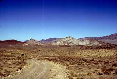
SLIDE 42 (below) is a view of the Honeycomb Hills as approached from the southeast (view is northwest).
In most respects, the Honeycomb Hills resemble the Spor Mountain district in miniature. Topaz-bearing alkali rhyolite and tuff were erupted through Paleozoic carbonate rocks and Tertiary volcanic rocks about 4.7 Ma ago, covering a total area of not more than 3-4 square miles. Stratified tuff, containing pumice and fragments of volcanic rocks and lesser carbonate rocks, has been mineralized locally. Mineralized tuff contains clay and small amounts of fluorite and beryllium. No economic deposits have been found.
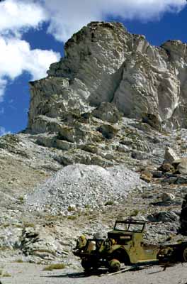
SLIDE 43 (left) shows East Honeycomb, the largest of the two rhyolite domes. Rhyolite in East Honeycomb and tuff beneath it have been prospected for beryllium.
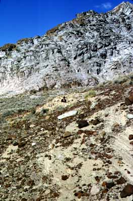
SLIDE 44 (right) shows West Honeycomb and the low saddle between the hills. The saddle is composed of tuff that has been prospected. Tuff at the base of West Honeycomb, shown on the skyline, is weakly mineralized and has been prospected extensively.
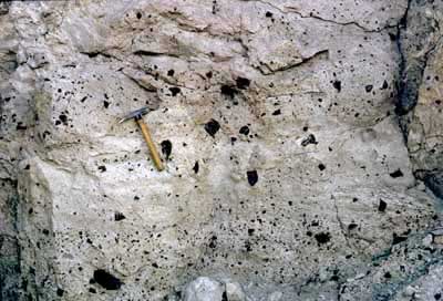 SLIDE 45 shows tuff exposed in the prospect between the hills; it is
not mineralized. Bedding and volcanic rock fragments are well-preserved;
carbonate rock fragments are sparse.
SLIDE 45 shows tuff exposed in the prospect between the hills; it is
not mineralized. Bedding and volcanic rock fragments are well-preserved;
carbonate rock fragments are sparse.