

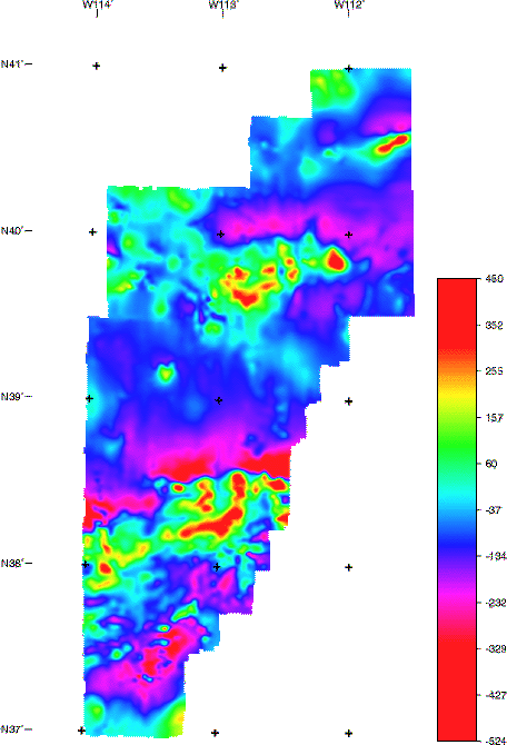
The aeromagnetic data are presented as four different grids that cover the entire state and two additional grids covering parts of the state. These maps are constructed from grids that combine information (see data processing details) collected in 20 separate aeromagnetic surveys conducted between 1952 and 1979. An index plot gives an overview of the flightline spacing of the original surveys. A data table summarizes the detailed specifications of the surveys.
This map displays a blended or merged grid of surveys C, H, I, and J at the original flight elevation of 9,000 ft barometric elevation. [filename = west9000]
| AccessibilityFOIAPrivacyPolicies and Notices | |
| |
|