Open-File Report 99-7-B
Introduction
Modern time-domain electromagnetic systems now record the induced signal as a vector and in enough time channels so that the resulting data can be used to investigate flat lying conductors as well as steeply dipping ones. Such systems can therefore be used to provide insight into such questions as the distribution of silt and clay (generally conductive) relative to sand and gravel (generally less conductive) in basin fill sediments and the conductivity of the ground water due to impurities (e.g., calcium from limestone or metallic sulphides). These results have important applications in hydrologic studies of ground water quality and quantity (for example, Wolfgram and Karlik, 1995), and in geologic studies of the basin fill which also bear on hydrologic issues.
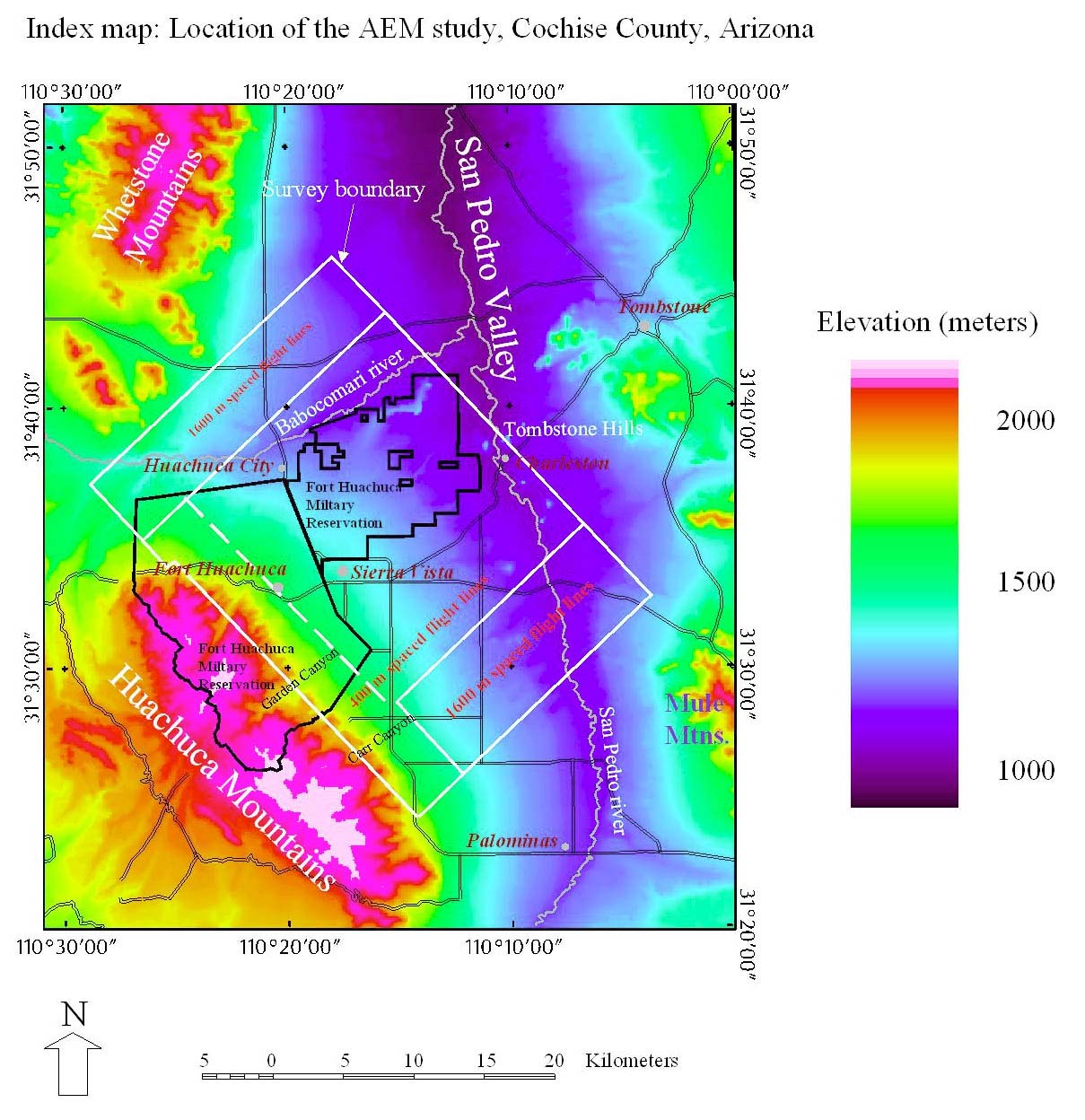
The upper San Pedro Valley in southeastern Arizona is an area of concern over ground water resources due to competing land uses which include commercial development, preservation of riparian environment, and mandated sustainability of water resources. In early 1997 an airborne electromagnetic survey was flown over the Fort Huachuca Military Reservation and immediately surrounding areas (Index Map). The objectives were to gather data which would be used to help map geologic structures which might control ground water flow, to map the distribution of areas containing significant volume fraction of silt and clay in three dimensions, and to evaluate the utility of the method in mapping the depth to water beneath the Earth's surface. In addition, the survey provided a map of the magnetic anomaly field which was used to define the location of faults and fractures in the rocks beneath the basin (and in some cases within the basin fill) and to provide another set of estimates of depth of fill of the basin.
We are unaware of any previous airborne electromagnetic surveys over the area. Pool (1998) has collected and analyzed ground-based electric soundings and profiles at selected sites in the area, and the area is included in regional aeromagnetic surveys at 1 mi. spacing between flight lines (Andreasen and others, 1965) and at 1/3 mi. spacing by proprietary mine company data. Geophysical logs of nine test wells on the Military Reservation are available (U.S, Army Corps Of Engineers, 1972, 1974) and were used for evaluation of the airborne data. The Arizona Department of Water Resources (written comm., 1998) provided a digital dataset of water well locations and depths to water measured within the last few years for comparison to the electromagnetic data interpretation. Gettings and Gettings (1996) collected and interpreted a detailed ground magnetic profile from the Dragoon Mountains southwest across the valley to the East Gate of Fort Huachuca. Gettings and Houser (in prep.) have collected, compiled and interpreted gravity anomaly, water and exploration borehole geologic logs, and surface geologic data to model the depth and shape of the basin in the Sierra Vista to Huachuca City area. Significant amounts of proprietary geologic, geophysical, and geochemical data collected by mineral exploration companies exists in areas of bedrock outcrop in the vicinity exists but were not available for this work.
The following chapters present our interpretation of the magnetic and electromagnetic data to date. The method is very successful at mapping conductors at depth and in defining geologic structures. Estimation of depth to water table was locally successful and may actually be mapping zones of significant silt and clay content that are coincident with the water table. the CD-ROM version of this publication (USGS Open-File Report 99-7-A available by calling (888) ASK-USGS) contains the data collected during this survey.
In general, the survey data have met their objectives, but as a result of questions which have arisen during the interpretive work, several new avenues of research merit further attention. These include; 1) Distinguishing the source of the upper resistivity minima, are they due to conductive water, or to wet fines containing clay? 2) Can different methods of transformation or inversion of the AEM data improve the conductivity-depth function resolution. 3) Are the deep conductors in the northeast part of the survey area truly the volcanic rocks of the Tombstone Caldera at depth as suggested in this study? 4) Is the origin of the deep low resistivity basin fill outside the Caldera due to weathered tuffaceous rock from the Tombstone caldera?
References

![]() U.S. Department of the Interior |
U.S. Geological Survey
U.S. Department of the Interior |
U.S. Geological Survey
URL: http://pubsdata.usgs.gov/pubs/of/1999/0007-b/intro.html
Page Contact Information: GS Pubs Web Contact
Page Last Modified: Wednesday, 07-Dec-2016 17:50:56 EST
