Skip Links

USGS - science for a changing world

U.S. Geological Survey Open-File Report 99–144

Digital Geologic Map of the Sandpoint 1- by 2-Degree Quadrangle, Washington, Idaho, and Montana

By Fred K. Miller, Russell F. Burmester, David M. Miller, Robert E. Powell, and Pamela D. Derkey

Thumbnail of and link to report PDF (1.5 MB)Introduction

The geology of the Sandpoint 1° x 2° quadrangle, Washington, Idaho and Montana, was mapped by Fred K. Miller, Russell F. Burmester, David M. Miller and Robert E., Powell during various periods between 1963 and 1995 and was compiled in 1995. The, compilation was made on a 1:250,000-scale greenline mylar of the topographic base map, and then scribed. The analog map was then converted to a digital format during 1997 and, 1998 for use in a geographic information system (GIS). The resulting digital geologic, map GIS can be queried in many ways to produce a variety of geologic maps. Digital, base map data files (topography, roads, towns, rivers and lakes, etc.) are not included:, they may be obtained from a variety of commercial and government sources. This, database is not meant to be used or displayed at any scale larger than 1:250,000 (for example, 1:100,000 or 1:24,000).

The map area is located in north Idaho. This Open-File report describes the geologic map units, the methods used to convert the geologic map data into a digital format, the Arc/Info GIS file structures and relationships.

Support for all geologic mapping of the quadrangle was provided by the National Cooperative Geologic Mapping Program. Support for all digital preparation was provided by the Mineral Resources Program.

Even though this is an Open-File Report and includes the standard USGS Open-File disclaimer, the authors of the report have tried to closely adhere to the U. S. Geological Survey and IUGS rules for stratigraphic nomenclature.

We wish to thank R.W. Tabor and S.E. Box for reviewing the manuscript and Pamela Cossette for reviewing the digital GIS files.

Last modified June 7, 2012
First posted October 5, 1999

Files for viewing and plotting

GIS data

  • This report is available only on the Web.

For additional information:
Contact Information, Geology, Minerals, Energy, and Geophysics Science Center
Mineral and Environmental Resources, Spokane Office
U.S. Geological Survey
904 W. Riverside Ave., Room 202
Spokane, WA 99201
http://minerals.usgs.gov/west/

Part of this report is presented in Portable Document Format (PDF); the latest version of Adobe Reader or similar software is required to view it. Download the latest version of Adobe Reader, free of charge.


Suggested citation:

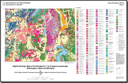
Miller, F.K., Burmester, R.F., Miller, D.M., Powell, R.E., and Derkey, P.D., 1999, Digital geologic map of the Sandpoint 1- by 2-degree quadrangle, Washington, Idaho, and Montana: U.S. Geological Survey Open-File Report 99–144, pamphlet 71 p., 1 sheet, scale: 1:250,000, and GIS data. (Available at https://pubs.usgs.gov/of/1999/0144/.)


Accessibility FOIA Privacy Policies and Notices

Take Pride in America logo USA.gov logo U.S. Department of the Interior | U.S. Geological Survey
URL: http://pubsdata.usgs.gov/pubs/of/1999/0144/index.html
Page Contact Information: GS Pubs Web Contact
Page Last Modified: Wednesday, 07-Dec-2016 17:50:52 EST