![]()
Open-File Report 99-219 contents page
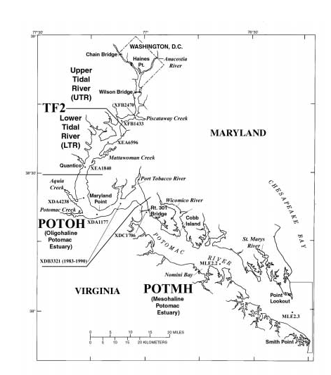 |
| Figure 1. Map--.Chesapeake Bay Program segments and stations for the tidal Potomac River and Potomac Estuary. Station numbers correspond to State of Maryland Department of Natural Resources mainstem monitoring stations. |