| Explanation: core logs and sedimentary facies | ||
| gravel (> 60% gravel) | 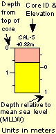 |
|
| gravelly sand (< 3% mud and 25-60% gravel) | ||
| sand (< 3% mud and < 25% gravel) | ||
| muddy sand (3-50% mud) | ||
| mud (> 50% mud) | ||
| Pleistocene facies | ||
| Miocene (limestone and blue-green clay) | ||
| Explanation: core logs and sedimentary facies | ||
| gravel (> 60% gravel) | |
|
| gravelly sand (< 3% mud and 25-60% gravel) | ||
| sand (< 3% mud and < 25% gravel) | ||
| muddy sand (3-50% mud) | ||
| mud (> 50% mud) | ||
| Pleistocene facies | ||
| Miocene (limestone and blue-green clay) | ||
Seven generalized sedimentary-facies types were defined for a unified comparison of core data from the entire study area. All seven color-coded facies for the entire study are shown in the Explanation below. However, not all facies necessarily are present on each transect. Core photographs present individual cores cut into 1-m sections from top (upper left) to bottom (lower right). Discrepancies in core length between the photographs and the diagrams are due to compaction during the coring process. Offshore cores (left) are aligned at core tops. Core locations were chosen to sample thicker Holocene sections and to aid in identifying pre-Holocene stratigraphy. Core elevations were determined from water depth and tide tables. The datum for the barrier-transect cores is the mean lowest low water (MLLW).
The offshore core photo USGS-95-119 (left) is located 2 km south of the main transect on a northwest-trending sand ridge (see section H-I). Vibracore USGS-95-119 is a good representation of the thin sand facies containing black grains that is found throughout the southern portion of the west-central Florida study area.
Offshore core retrieval was consistently less than 1 m in length. The contorted bottom of the barrels indicates that cores penetrated the entire sediment thickness. Sediment cover consists dominantly of blackened sands interpreted as phosphatic-rich grains derived from older Miocene sequences. Shelly sand and gravel represent modern open-marine conditions. Quartz-rich sediments occur only within a few kilometers of shore in this part of the study area. The thin, discontinuous sediment cover is in contrast to the thicker, quartz-dominated sediment cover in the northern portion of the study area.
The island cross section (Yale, 1997) indicates the barrier island is situated against a rising limestone bedrock surface. In the two landward-most cores, the Miocene limestone surface was penetrated immediately below the surficial sediment sand layer, once again indicating the paucity of sediments on this part of the shelf (see seismic data showing restricted extent of sand bodies). On cross sections where cores do not penetrate to bedrock, the control is based on probe-rod data.