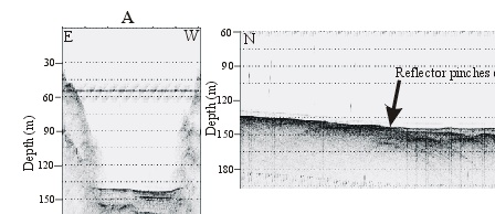
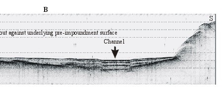
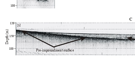
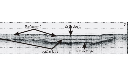
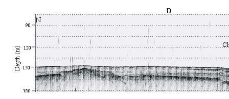
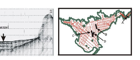
Figure 13. Four seismic profiles showing the acoustic stratigraphy of the sediments filling the lake:
A: profile form Boulder Canyon showing flat-lying sediments abutting the steep canyon walls.
B: profile immediately south of Callville Bay showing the channel and pinching out of sediment against the gentle northern slope.
C: profile south of Swallow Bay showing four reflectors in the post-impoundment section. Note that all of them are nearly horizontal and that the deeper ones are not laterally as extensive as the shallower ones.
D: profile in the western part of Boulder Basin showing that the channel is still present here. Profile locations shown on inset map.
|
|
|
|
|
|