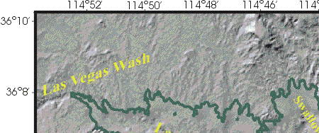
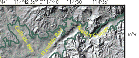
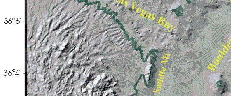
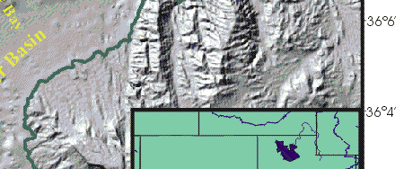
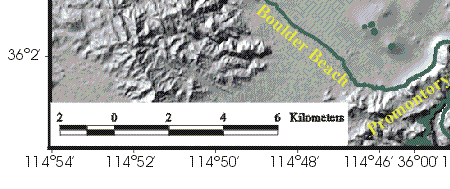
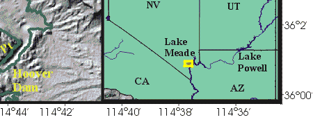
Figure 1. Location map showing the morphology of the western part of Lake Mead and the surrounding area. Morphology is shown as a shaded-relief image that was derived from combining a digital elevation model of the surrounding landscape (USGS, 1999) with a gridded version of the bathymetry collected during this survey. Green line is the approximate location of the shoreline (360 m contour), and names are places referred to in the text. Inset shows the location of the study area (yellow box).
|
|
|
|
|
|