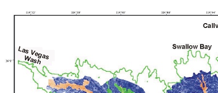
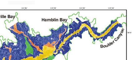
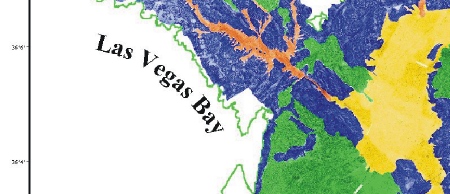
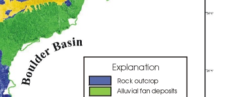
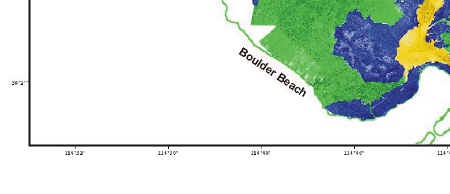
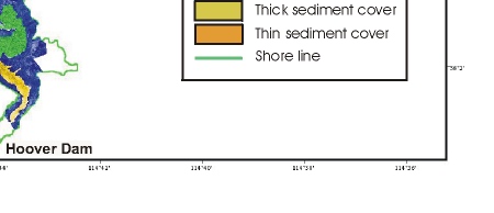
Figure 5. Interpretation of the sidescan sonar image from the Boulder Basin and Las Vegas Bay parts of Lake Mead. The lake floor is divided into four general provinces. Alluvial: unconsolidated sand and gravel that was deposited primarily as alluvial fans prior to the formation of the lake. Rock: areas of exposed rock outcrop, and, like alluvial deposits, indicates areas of the lake floor that have not been covered by sediment (or only have a minimal sediment cover) since the lake formed. Thick sediment: sediment that has accumulated since impoundment that is more than 2-m thick. Thin sediment: sediment that has accumulated since impoundment that is less than 2-m thick, and often is too thin to be resolved by the seismic system used to map sediment thickness (ie. less than 0.5 m thick).
|
|
|
|
|
|