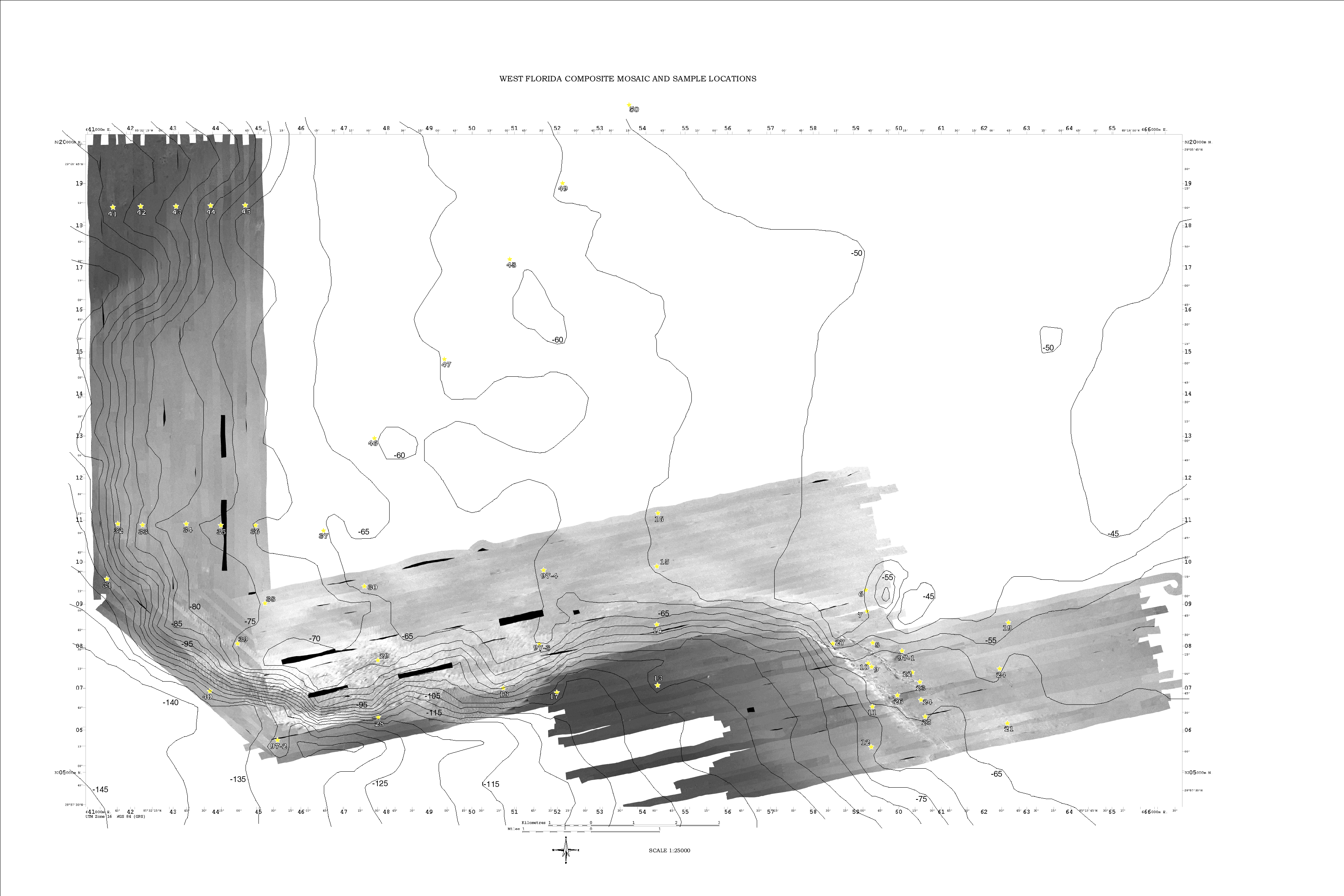
(click on image below to view or download image)
Bathymetry and Sidescan depths in meters Bathymetry Data Source: National Geophysical Data Center. 1998. NOS Hydrographic Survey Data -U.S. Coastal Waters- CD-ROM Set v4. Data were contoured using Arcview's Spatial Analyst Extension.
Study Area Regional Bathymetry
Contents: Table of Contents GIS Data Sample Locations in West Florida Shelf General Bathymetry Sidescan Sonar Gallery Sediment Data Sediment Charts and Composite Mosaic Interpretation/Text Interpretation/Graphic Seismic Profiles For More Information... Home