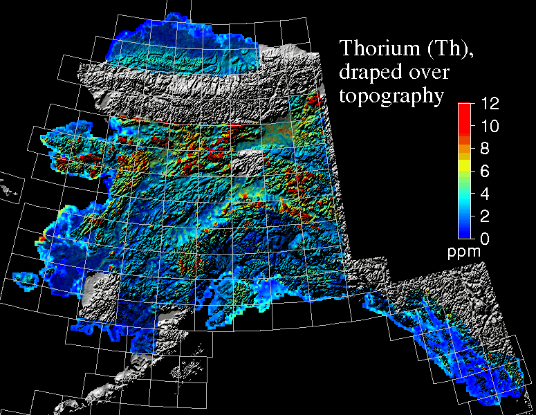
CAPTION: This map is a display of equivalent thorium (eTh) in parts-per-million (ppm) draped over a shaded 300 m digital elevation model of Alaska (Riehle and others, 1996).