
![]()
![]()
U.S. DEPARTMENT OF THE INTERIOR
U.S. GEOLOGICAL SURVEY
|
THE DINGO-MUNGAROO/BARROW AND
by Michele G. Bishop1 |
Open-File Report 99-50-E
| The zone of peak hydrocarbon
generation (Barber, 1988) is 1 km thick beginning at approximately 3 km
depth on the Peedamullah shelf in the east where it intersects mostly Permian
section. Further west, offshore in the Barrow-Dampier sub-basins, upper
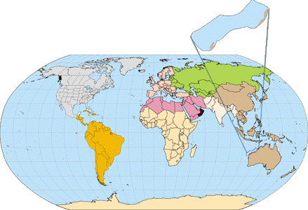
Jurassic rocks are currently within the peak oil window (Fig.
5).
The Jurassic Dingo Claystone is thick within the sub-basins and thin on the Exmouth Plateau and is only mature in the area of the sub-basins (Fig. 6a)(Barber, 1988). Accumulations of Dingo-Mungaroo/Barrow TPS 394801 (Fig. 7a), are within the Jurassic sub-basin trend or directly overlying it and in fault blocks along the edges of the sub-basin trend where lateral migration into adjacent sandstone reservoirs could occur (Fig. 5). Triassic Locker Shale and Mungaroo deltaics of the Locker-Mungaroo/Barrow TPS 394801, underlie all of Province 3948 and thus could be potential source rocks. The Triassic rocks were buried deeply in the sub-basin trend during Jurassic subsidence and would have become over-mature in the area at that time (Fig.4 and Fig. 6). In the Exmouth Plateau region the same potential section has thin Jurassic, Cretaceous and Cenozoic overburden (Fig. 5). The Triassic source rocks under the Exmouth Plateau entered the oil window in Late Triassic time and these rocks have remained within the oil window (Fig. 6b). The Triassic interval in this location is interpreted as the source for overlying shows and discoveries (Fig. 7b). OVERBURDEN ROCK
As the supply of clastic sediment decreased during Cretaceous and Tertiary time and the Northwest Shelf portion of the Australian tectonic plate drifted to tropical latitudes, deposition of radiolarite, marl, calcilutite, calcarenite, siltstones, and limestones dominated and continues into the present (Fig. 3). The Cenozoic carbonate shelf is up to 3 km thick offshore (Stagg and Colwell, 1994). The carbonate sequence records small unconformities related to sea level fluctuations (Stagg and Colwell, 1994) and a period of minor tectonic activity. Burial history analysis (Barber, 1988) indicates steady subsidence since Cretaceous time and the generally different histories of the plateau and the sub-basin trend (Fig. 6a and b). Overburden for the Lower Dingo Claystone consisted of Jurassic shales and sandstones in the subsiding sub-basins. The oldest Dingo Claystones may have been within the oil window while the younger strata were being deposited. Post-Jurassic overburden includes sandstones of the Cretaceous delta over the Exmouth and Barrow sub-basins and shale over the Dampier and Beagle sub-basins. Post-Neocomian deposition involved the establishment of a carbonate shelf. The current shelf edge lies over the Rankin Platform trend. Triassic source rocks experienced little overburden on the Exmouth Plateau during the Jurassic Period but have shared a thinner section of post Neocomian clastic and carbonate deposits. The Triassic was buried deeply and quickly during Jurassic faulting and subsidence of the Barrow and Dampier sub-basin trend. At the southern and eastern edges of the Exmouth and Barrow sub-basins the Triassic was buried less deeply. TRAP STYLE
|
North Herald, Chervil, Saladin,
Yammaderry, Cowle among other discoveries are examples of traps formed
where downthrown Muderong and Gearle shales (Winning Group) seal the upthrown
Barrow Group and Birdrong sands (Parry and Smith, 1988). Some stratigraphic
traps are combined with structure and are draped in structurally high positions
on fault-block trends.
Trap style on the Rankin Platform trend involves tilted fault blocks sealed by an erosional unconformity and overlying Muderong Shale. Hydrocarbon accumulations are found in stacked sands of the Mungaroo Formation. Some stacked reservoirs share a down-dip oil/water contact in a fault block. According to Stein and Scott (1993), "The Rankin Platform is one of the most prolific hydrocarbon provinces in the Australasian region, with discovered recoverable reserves estimated to be in excess of 25 TCF of gas, 700 MMBBL of condensate and 200 MMBBL of oil.". Trap style on the Exmouth Plateau is the same as that of the Rankin Platform trend, tilted fault blocks of Triassic Mungaroo reservoir rocks. Traps over the Exmouth Plateau in Barrow Group reservoirs are structural highs due to post-Neocomian reactivation of post-Triassic faults. Onshore and on the inner structural terraces, trap style includes the faulted anticlines of Rough Range and Rivoli fields (Lawry and Carter, 1992), and fault traps of Turbidgi field (Thompson, 1992). By far, the most important reservoir of Province 3948 Northwest Shelf is the Barrow Group, which accounts for estimated recoverable reserves of more that 400 MMBO, 4 TCFG, and 108 million barrels of condensate (MMBC) in the Dingo-Mungaroo/Barrow 394801 petroleum system. More than 35 MMBO, 44 TCFG, and 836 MMBC are assigned to the Mungaroo Formation. Major traps were formed by post-Triassic faulting. Reactivation of these faults and post-Cretaceous basin inversion, particularly on the Exmouth Plateau, allowed migration into overlying sediments. The Roebuck Basin may have been more stable after initial post- Triassic tectonics (Stagg and Colwell, 1994). Stratigraphic traps formed by depositional and compactional relief, combined with fault-block drapes with occasional minor faulting, and tilted fault blocks comprise the major trap types in Triassic, Jurassic, and Cretaceous reservoirs. Much remigration has occurred due to reactivation of faults and spilling from over-filled structures. RESERVOIR ROCK
The Triassic Mungaroo Formation is a major reservoir in fault blocks tilted by post-Triassic tectonics (Fig. 5). The Ladinian to Rhaetian age Mungaroo Formation consists of fluvial, deltaic, and alluvial sediments prograding from the continent, in a modern northwest direction, across the inner structural terraces, across what would become the sub-basin trend, and grading into prodelta marine sediments toward the far edge of the Exmouth Plateau (Barber, 1988). Jurassic deltaic, alluvial, and deep-water siliciclastic deposits shed from the stable continent were deposited in the subsiding sub-basin trend. These clastic intervals are also important producing reservoirs. The Neocomian Barrow Group delta prograded northeastward across the Exmouth Plateau and into the Barrow sub-basin. The northern limits of topsets of the Barrow Group reach from Vinck-1 east to Investigator-1 wells and across to Gorgon field and the northern end of Barrow Island (Barber, 1988), roughly perpendicular to the modern coast (Fig. 2). Clastics, shed from the Indian plate, accumulated until the plate separated and drifted north, cutting off sediment supply in the Hauterivian Stage. |