PROVINCE
GEOLOGY

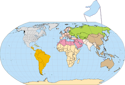
The Browse Basin Province 3913 is situated offshore of
Western Australia along the northern coast (Fig. 1). Most of the province
lies in the Timor Sea. It includes the Territory of Ashmore and Cartier
Islands, Australia (Fig. 2). The province is bounded to the north by the
waters of Indonesia, to the southwest by the Northwest Shelf Province 3948,
to the northeast by the Bonaparte Gulf Basin Province 3910 and to the southeast
by the offshore part of the Kimberley Basin craton. Most of the province
lies within the jurisdiction of offshore Western Australia; the remainder
within the waters of the Territory of Ashmore and Cartier Islands (Fig. 2).
The Browse Basin covers an area of approximately 105,000
km2 between the Scott Plateau and the Ashmore Platform to the
west and north and offshore portions of the Kimberley Block to the east
(Butcher 1989) (Fig. 2). The Scott Plateau covers another 80,000 km2
(Stagg, 1978).
Main units of the province include, from the eastern edge
of the Scott Plateau, the Seringapatam sub-basin or outer Browse sub-basin,
the central or Caswell sub-basin, the inner Browse sub-basin, and the southern
portion of the Vulcan sub-basin (Fig. 2). Along the eastern edge of the
province, sediments of the Browse Basin onlap subsurface extensions of
the Kimberley Block. These extensions are known as the Yampi Shelf, the
Leveque Shelf to the south, and the Londonderry High (or Arch) to the north
(Fig. 2). A hinge zone on the margin of the Yampi Shelf defines the edge
of the Prudhoe structural terrace. Ocean crust of the Argo Abyssal Plain
lies west of the Scott Plateau. The Ashmore Platform and the Timor Trough
lie to the north (Hocking and others, 1994; Baillie and others, 1994; Haston
and Farrelly, 1993; Willis, 1988; Stephenson and Cadman, 1994).
The Kimberley Block consists of approximately 5 to 8 km
of Proterozoic basin rocks over approximately 9 km of Archaean rocks (AGSO
North West Shelf Study Group, 1994). The Yampi Shelf is composed of Cretaceous
and Tertiary sediments that overlie Precambrian basement of the Kimberley
Block. Further west, the Prudhoe Terrace consists of steeply dipping Precambrian
basement rocks that are onlapped by northeast trending block-faulted Permian
sediments, which are in turn onlapped by Late Jurassic age clastics. Total
estimated thickness of Mesozoic strata is 3.5 km. Permian through Jurassic
age sediments pinch out on the flanks of the Scott Plateau, which consists
of Precambrian and Paleozoic rocks. A thin section of Cretaceous and Recent
sediments are present on top of the plateau (Stephenson and others, 1994).
The Kimberley Block and the Scott Plateau are considered to be the sources
of clastics within the Browse Basin. Portions of the Ashmore Platform were
emergent from Late Triassic through Cretaceous and may also have contributed
sediment to the province (Bradshaw and Sayers, 1996).
|
This province is part of the Westralian Supersystem (Bradshaw,
1993) that reaches from the Exmouth Plateau (to the southwest), northeast
to Papua New Guinea and links basins that share an history of extension,
breakup and sea floor spreading during the Jurassic and Early Cretaceous
(Bradshaw and others 1994). The basins of this offshore margin share an
overall stratigraphy of Triassic to Cretaceous reservoirs that were sourced
primarily by Jurassic rocks, sealed by Cretaceous rocks and overlain by
Cretaceous and Tertiary shelf carbonates (Fig. 3).
The Browse Basin began to accumulate sediments in the
Carboniferous. Sediments accumulated in the intracratonic basin or continental
seaway that formed roughly along the present shelf and connecting the Paleozoic
Canning rift basin with the Paleozoic Bonaparte Gulf rift basin around
the seaward edge of the Kimberley Block (Stephenson and Cadman, 1994) (Fig.
3 and Fig. 4). The majority of subsidence and sediment accumulation occurred
in Cretaceous time (Bradshaw and others, 1994). The region received mostly
coastal plain, deltaic, and shallow water sediments during Triassic to
early Late Jurassic (Oxfordian) times. It was connected north to the Tethys
Sea between the Ashmore Plateau and a continental block that included the
Scott Plateau (Bradshaw and others, 1994). Occasional marine connections,
southwest, to the Rowley sub-basin and a persistent marine passage, north,
between the Scott Plateau and the Ashmore Platform are present on maps
by Bradshaw and Sayers (1996). Faulting in Triassic time followed by Jurassic
rifting, resulted in the separation of a continental block from the Scott
Plateau and formation of the Argo Abyssal Plain in Late Jurassic. These
events produced northeast-trending tilted fault blocks, subsidence of the
central basin, uplift of the Ashmore Platform and Scott Plateau, basalts,
tuffs, and volcanics, and a widespread late Middle Jurassic (Callovian)
to middle Late Jurassic (Kimmeridgian) breakup unconformity (Willis, 1988;
Stephenson and Cadman, 1994). The subsequent drift phase resulted in extensive
marine flooding of the Browse Basin that began in the central portions
of the basin and eventually flooded highs and the eastern basin margin.
The Scott Reef trend was covered by Upper Jurassic (Tithonian) marine claystone.
Open ocean circulation occurred in middle Cretaceous with subsidence of
the Ashmore Platform and the Scott Plateau. Younger tectonic events in
the northern part of the basin are associated with the Timorese Tertiary
orogeny.
The Browse Basin contains Permian, Mesozoic and Cenozoic
rocks that reach a maximum thickness of 17 km in the central or Caswell
sub-basin (Hocking and others, 1994). Approximately 8 km of Late Carboniferous-Early
Permian shallow marine, deltaic carbonates, and clastics were deposited
adjacent to the Prudhoe terrace. These sediments onlap basement to the
southeast, and thin to the northwest.
|