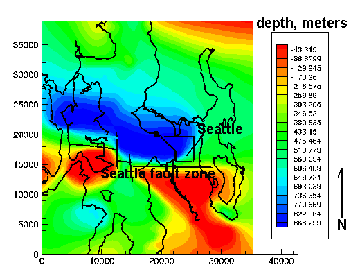
Figure 13
--Map of elevation of base of Quaternary from industry seismic reflection and USGS marine reflection data. Unpublished results from Sam Johnson, USGS, 1999. X and Y axes are in meters.