| Prev |
| Next |
| Map |
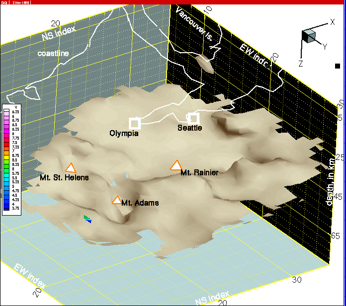
An outline of the coast, two major cities and 3 volcanoes have been added to this view of the 7.5 km/s isosurface and will be present on succeeding images. Because of the perspective view and the fact that the geographic data is registered to the top of the model grid, features in the images do not appear directly below geographic features. In the next image we discuss features of the isosurface.