| Prev |
| Next |
| Map |
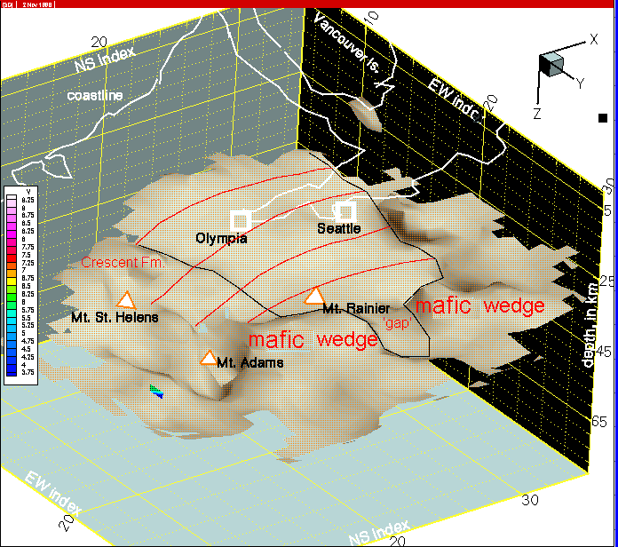
A few features of the 7.5 km/s isosurface are noted in this image. We interpret that 7.5 km/s velocites represent the Juan de Fuca mantle, the overlying mafic/ultramafic wedge (see 2D cross-section and geologic interpretation on previous pages), as well as some deep sections of Crescent Fm. mafic rocks. The black line shown here encloses uncomplicated velocity structure along the axis of the Juan de Fuca plate arch. The red line indicates approximate relief on the arch. Two key sections of the 'mafic wedge' are separated by an obvious 'gap'. The block of Crescent Fm. basement noted intrudes into sedimentary rocks of the Olympic Mts. region.