| Prev |
| Next |
| Map |
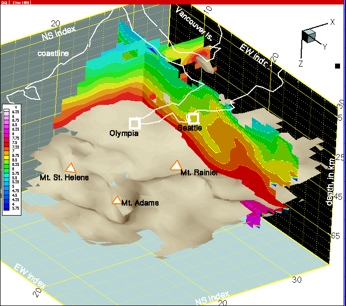
Figure 26--The deep wedge of accretionary prism sediments is thinned on this section at row 29 and will be completely truncated on the next section (row 30), which is out of the wedge gap.
| wa016.html | row 29 | col 8 | western Washington tomography | p-wave model | |||||
|
Figure 26--The deep wedge of accretionary prism sediments is thinned on this section at row 29 and will be completely truncated on the next section (row 30), which is out of the wedge gap. |
||||||||