| Prev |
| Next |
| Map |
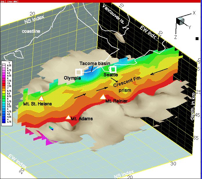
Figure 36--On this column 20 cross-section, the tight packing of remaining prism sediments and surrounding Crescent Fm. is caused by forcing these units into the 'gap' and by north-south shortening over the top. In addition, the west end of the Tacoma basin is illustrated.