The initial goal of the Alaska Magnetic project has been to construct a digital compilation grid of aeromagnetic data to serve as a basis for regional interpretation and a framework for local-scale work. Working with the State of Alaska, Division of Oil and Gas, and the firm of Paterson, Grant, and Watson, Ltd., we completed a compilation of central Alaska in 1994. The minerals program at the USGS then funded the effort to complete a state-wide compilation that we released on the web in 1997. Northwest Geophysical Associates was our primary contractor for much of the digital data processing.
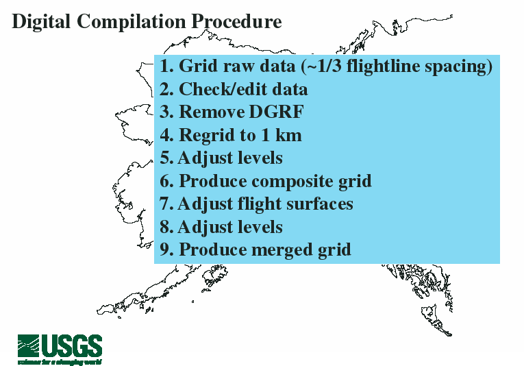
Here are the basic steps we followed to produce the composite and merged aeromagnetic data grids. Many of these steps involve detailed attention by data processing experts. The raw data were generally gridded using the minimum curvature algorithm. Some data sets were gridded using bi-directional gridding. The Oasis/montaj proprietary geophysical data processing system was used for most of the processing. Data processing was mostly done on contract. Interior Alaska was compiled by Paterson, Grant, and Watson (Toronto) under contract to the State of Alaska, Division of Oil and Gas. The rest of the state was compiled by Northwest Geophysical Associates (Corvallis, OR) under contract to the U.S. Geological Survey.
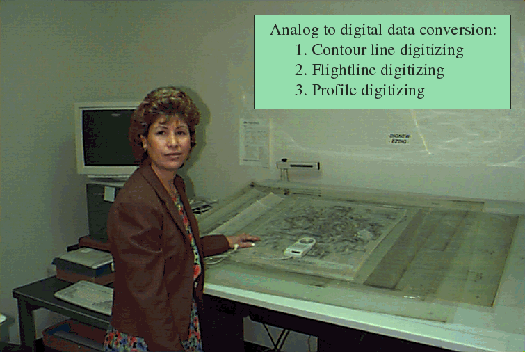
A big part of the Alaska Magnetic project effort is data rescue - all data collected before the mid-70s are analog in original form and must be digitized. In some cases the paper records are obscure (Pat Hill is critical here) and/or in bad shape. The primary digitizer for this effort is Esther Castellanos of Digimap, Inc., Denver, CO.
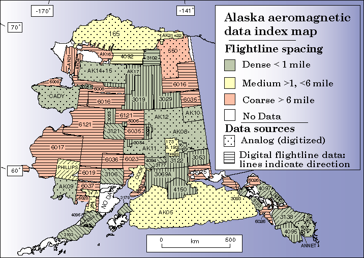
Here is an overview map of the 85 surveys that we incorporated in the digital compilation grids for Alaska. The surveys overruled by a line pattern were available in raw digital form. The polka-dots show surveys that were digitized from analog records. Flightline spacing is mostly medium or coarse in Alaska, and some regions have no available coverage.
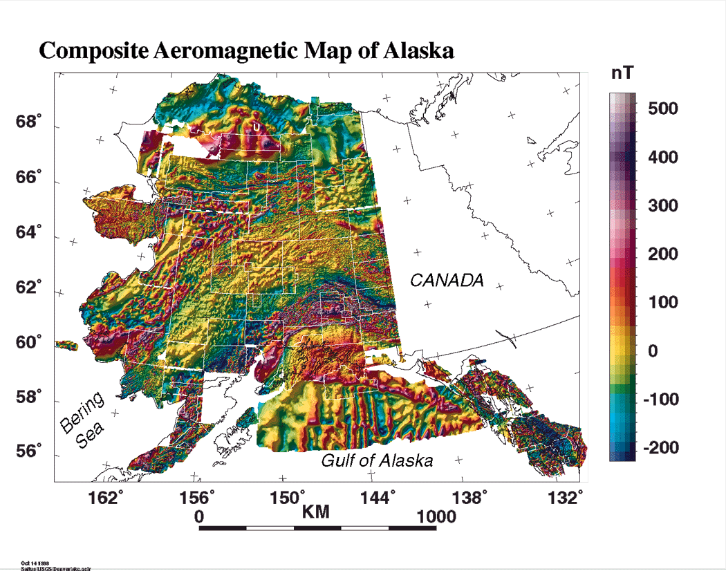
This is a shaded relief image (illumination from the northwest) of the composite aeromagnetic data compilation grid. Blank cells (white spaces) were left in the grid to indicate boundaries of the original aeromagnetic surveys. Differences in data resolution are apparent - for example, the surveys in northeastern Alaska lack the resolution of adjacent data to the west and south. In this compilation each dataset is gridded at the original resolution - no upward or downward continuation have been used to match data values at boundaries. Instead, simple datum shifts (addition or subtraction of a constant) have been used to produce a visually pleasing mosaic.
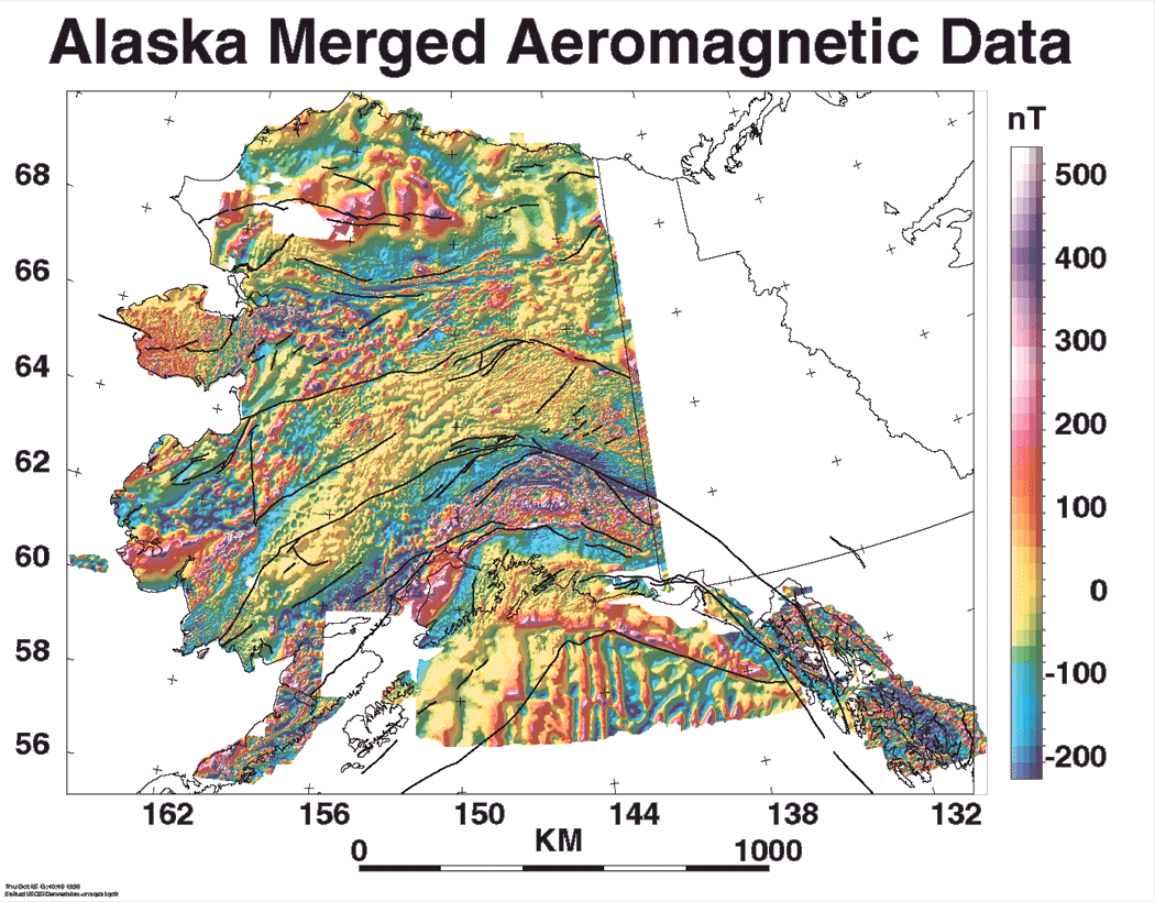
This is a shaded relief image (illumination from the northwest) of the merged aeromagnetic data. Individual datasets have been adjusted mathematically (upward and downward continued) to produce a uniform specification of 1,000 ft (305 m) draped above terrain. This grid provides a consistent basis for digital filtering of these data. The black lines are major faults.