 |
|
|
||||
| MD-DE-DC Water Science Center |
U.S. GEOLOGICAL SURVEY
Open-File Report 99-85
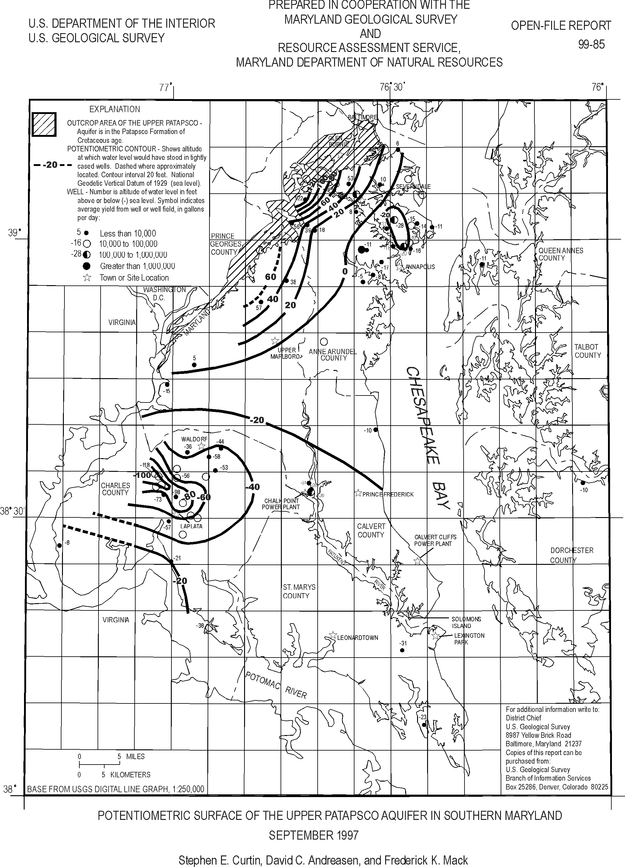
This report presents a map showing the potentiometric surface of the Upper Patapsco aquifer in the Patapsco Formation of Cretaceous age in Southern Maryland during September 1997. The map was prepared from water-level measurements in 42 wells. The potentiometric surface was 122 feet above sea level near the northern boundary and outcrop area of the aquifer in a topographically high area of Anne Arundel County, and 57 feet above sea level in a similar setting in Prince Georges County. From these high areas, the potentiometric surface declined to the southeast toward large well fields in the Annapolis area and Arnold and from all directions toward a cone of depression southwest of Waldorf. Ground-water levels reached 20 feet below sea level in the Annapolis area, 28 feet below sea level at Arnold, and 118 feet below sea level southwest of Waldorf.
This report is available as a GIF file (Large Print Size) and in Portable Document Format (PDF)(8½ x 11 printed size).
View the OFR 99-85 report in GIF (187 KB)
View the OFR 99-85 report in PDF (117 KB)
This report is available online in Portable Document Format (PDF). If you do not have the Adobe Acrobat PDF Reader, it is available for free download from Adobe Systems Incorporated.
Document Accessibility: Adobe Systems Incorporated has information about PDFs and the visually impaired. This information provides tools to help make PDF files accessible. These tools and the accessible reader may be obtained free from Adobe at Adobe Access.
For more information about USGS activities in Maryland, Delaware and the District of Columbia contact:
Director
MD-DE-DC Water Science Center
U.S. Geological Survey
8987 Yellow Brick Road
Baltimore, MD 21237
or access the USGS Water Resources of Maryland, Delaware, and District of Columbia home page at: http://md.water.usgs.gov/.
| AccessibilityFOIAPrivacyPolicies and Notices | |
 |
|