Open-File Report 00-321
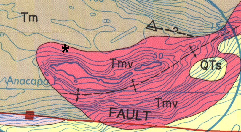
Figure 4. Portion of geologic map in the area of Anacapa Island from Vedder et al. (1986). Asterisk indicates location of rocks in figure 3. Location of Santa Cruz Island Fault shown in red. Tm indicates undifferentiated sedimentary bedrock of Miocene age. Tmv indicates volcanic bedrock of Miocene age.

![]() U.S. Department of the Interior |
U.S. Geological Survey
U.S. Department of the Interior |
U.S. Geological Survey
URL:
Page Contact Information:
Page Last Modified:
