
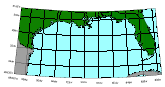
 2 degree graticule for Gulf of Mexico region
Metadata:
-
Identification_Information:
-
Citation:
-
Citation_Information:
-
Originator: U. S. Geological Survey
-
Publication_Date: 19980407
-
Publication_Time: Unknown
-
Title: 2degree graticule for Gulf of Mexico region
-
Description:
-
Abstract:
-
Contains a 2degree graticule for the Gulf of Mexico region.
-
Purpose:
-
This GIS overlay is a component of the U. S Geological Survey, Woods Hole
Field Center's, Gulf of Mexico ArcView GIS database. The Gulf of Mexico
GIS database is intended to organize and display USGS held data and provide
on-line (WWW) access to the data and/or metadata.
-
Time_Period_of_Content:
-
Time_Period_Information:
-
Single_Date/Time:
-
Calendar_Date: 19980405
-
Currentness_Reference: Publication Date
-
Status:
-
Progress: Complete
-
Maintenance_and_Update_Frequency: None planned
-
Spatial_Domain:
-
Bounding_Coordinates:
-
West_Bounding_Coordinate: -99.5
-
East_Bounding_Coordinate: -79.5
-
North_Bounding_Coordinate: 31.01
-
South_Bounding_Coordinate: 22.5
-
Keywords:
-
Theme:
-
Theme_Keyword_Thesaurus: General
-
Theme_Keyword: U.S. Geological Survey
-
Theme_Keyword: Coastal and Marine Geology Program
-
Theme_Keyword: Woods Hole Field Center
-
Theme_Keyword: Gulf of Mexico Database
-
Theme_Keyword: ArcView
-
Theme_Keyword: Geographic Information Systems
-
Theme_Keyword: polyline
-
Theme_Keyword: shapefiles
-
Place:
-
Place_Keyword_Thesaurus: General
-
Place_Keyword: Gulf of Mexico
-
Access_Constraints: None
-
Use_Constraints: None
-
Point_of_Contact:
-
Contact_Information:
-
Contact_Organization_Primary:
-
Contact_Organization: U. S. Geological Survey
-
Contact_Person: Valerie Paskevich
-
Contact_Position: Computer Specialist
-
Contact_Address:
-
Address_Type: mailing and physical address
-
Address: 384 Woods Hole Road
-
City: Woods Hole
-
State_or_Province: MA
-
Postal_Code: 02543-1598
-
Country: USA
-
Contact_Voice_Telephone: (508) 548-8700 x2281
-
Contact_Facsimile_Telephone: (508) 457-2310
-
Contact_Electronic_Mail_Address: vpaskevich@usgs.gov
-
Hours_of_Service: M-Thu 6:30am-3:30pm; Fri 6:30am-10:30am
-
Browse_Graphic:
-
Browse_Graphic_File_Name: gratic
-
Browse_Graphic_File_Description: GIF
-
Browse_Graphic_File_Type: 2degree graticule of Gulf of Mexico ArcView
project area
-
Native_Data_Set_Environment: ESRI Shapefile format
-
Spatial_Data_Organization_Information:
-
Direct_Spatial_Reference_Method: Vector
-
Point_and_Vector_Object_Information:
-
SDTS_Terms_Description:
-
SDTS_Point_and_Vector_Object_Type: Complete chain
-
Point_and_Vector_Object_Count: 18
-
Entity_and_Attribute_Information:
-
Detailed_Description:
-
Entity_Type:
-
Entity_Type_Label: gratic.dbf
-
Entity_Type_Definition: Shapefile Attribute table
-
Entity_Type_Definition_Source: None
-
Attribute:
-
Attribute_Label: Gratic
-
Attribute_Definition:
-
A text string to identify the graticule. The string, defined such as -89d
or 33d6'N, may be used to label the graticule on the map view.
-
Attribute_Definition_Source: User Defined
-
Attribute_Domain_Values:
-
Unrepresentable_Domain: Character field
-
Distribution_Information:
-
Distributor:
-
Contact_Information:
-
Contact_Organization_Primary:
-
Contact_Organization: U.S. Geological Survey
-
Contact_Person: Valerie Paskevich
-
Contact_Position: Computer Specialist
-
Contact_Address:
-
Address_Type: mailing and physical address
-
Address: 384 Woods Hole Road
-
City: Woods Hole
-
State_or_Province: MA
-
Postal_Code: 02543-1598
-
Country: USA
-
Contact_Voice_Telephone: (508) 548-8700 x2281
-
Contact_Facsimile_Telephone: (508) 457-2310
-
Contact_Electronic_Mail_Address: vpaskevich@usgs.gov
-
Resource_Description: Gulf of Mexico IMS 2degree graticule
-
Distribution_Liability:
-
Although this derived data set has been used by the USGS, no warranty,
expressed or implied, is made by the USGS as to the accuracy of the data
and/or related materials. The act of distribution shall not constitute
any such warranty, and no responsibility is assumed by the USGS in the
use of these data or related materials.
-
Standard_Order_Process:
-
Digital_Form:
-
Digital_Transfer_Information:
-
Format_Name: ARCE
-
Format_Information_Content:
-
geology.shp geology.dbf geology.shx
-
File_Decompression_Technique: No compression applied
-
Transfer_Size: 2,551Kb
-
Digital_Transfer_Option:
-
Offline_Option:
-
Offline_Media: CD-ROM
-
Recording_Capacity:
-
Recording_Density: 650
-
Recording_Density_Units: Mbytes
-
Recording_Format: ISO 9600
-
Compatibility_Information:
-
The user must have a system with a CD-ROM capable of reading an ISO-9660
standard CD-ROM disk. To browse the information contained on this disk,
the user must also have a current version of WWW browser available.
-
Fees: none
-
Standard_Order_Process:
-
Digital_Form:
-
Digital_Transfer_Information:
-
Format_Name: ARCE
-
Format_Information_Content:
-
The three ArcView shapefiles (gratic.dbf, gratic.shp, gratic.shx) comprising
the 2degree graticule (gratic) coverage for the ArcView Gulf of Mexico
project area.
-
File_Decompression_Technique: zip
-
Transfer_Size: 1689Kb
-
Digital_Transfer_Option:
-
Offline_Option:
-
Offline_Media: CD-ROM
-
Recording_Capacity:
-
Recording_Density: 650
-
Recording_Density_Units: Mbytes
-
Recording_Format: ISO 9600
-
Compatibility_Information:
-
The user must have a system with a CD-ROM capable of reading an ISO-9660
standard CD-ROM disk. To browse the information contained on this disk,
the user must also have a current version of WWW browser available.
-
Fees: none
-
Technical_Prerequisites:
-
There are no technical requirements for downloading the data. However to
use the ArcView shape files the user must have an ESRI software product
or some other GIS program that allows importing of ArcView shapefiles.
-
Metadata_Reference_Information:
-
Metadata_Date: 19990819
-
Metadata_Contact:
-
Contact_Information:
-
Contact_Organization_Primary:
-
Contact_Organization: U.S. Geological Survey
-
Contact_Person: Valerie Paskevich
-
Contact_Position: Computer Specialist
-
Contact_Address:
-
Address_Type: mailing and physical address
-
Address: 384 Woods Hole Road
-
City: Woods Hole
-
State_or_Province: MA
-
Postal_Code: 02543-1598
-
Country: USA
-
Contact_Voice_Telephone: (508) 548-8700 x2281
-
Contact_Facsimile_Telephone: (508) 457-2310
-
Contact_Electronic_Mail_Address: vpaskevich@usgs.gov
-
Metadata_Standard_Name: FGDC Content Standards for Digital Geospatial
Metadata
-
Metadata_Standard_Version: CSDGM version 2
-
Metadata_Time_Convention: Local time
-
Metadata_Access_Constraints: None
-
Metadata_Use_Constraints:
-
None. Acknowledgment of the U.S. Geological Survey would be appreciated
in products derived from these data.
Generated by mp
on Thu Aug 19 11:22:52 1999