 Figure
6. Sidescan-sonar image superimposed on the surficial geology map showing the crest of an
anticline exposed on the seafloor north of Grays Harbor (upper panel), and the
seismic-reflection profile collected along the same track (lower panel). Click on
the figure to view a larger image. Figure location shown in Fig. 4.
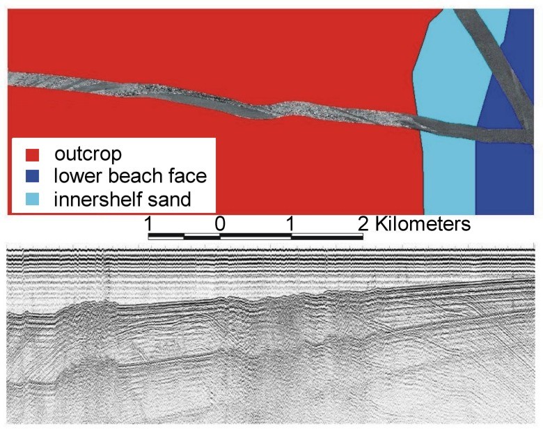
Figure
6. Sidescan-sonar image superimposed on the surficial geology map showing the crest of an
anticline exposed on the seafloor north of Grays Harbor (upper panel), and the
seismic-reflection profile collected along the same track (lower panel). Click on
the figure to view a larger image. Figure location shown in Fig. 4.