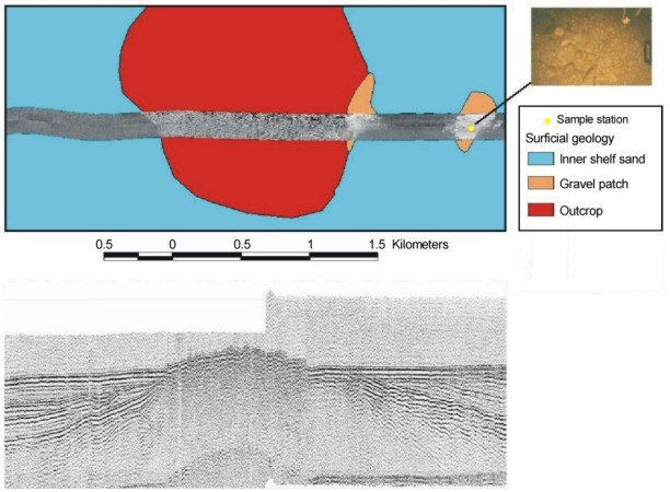
 Figure
7. Sidescan-sonar image superimposed on the surficial geology map showing a submerged sea
stack off Grayland (upper panel), and the seismic-reflection profile collected along the
same line showing this intrusive structure (lower panel). Photograph from the station in
the high-backscatter areas shows this area to be gravel. Click on the figure to view
a larger image. Figure location shown in Fig. 4.