Publication_Place: Woods Hole Field Center, Woods Hole, MA
Publisher: U. S. Geological Survey
Larger_Work_Citation:
Citation_Information:
Originator: Valerie Paskevich(ed.)
Originator: Larry Poppe(ed.)
Publication_Date: 20001101
Publication_Time: Unknown
Title:
Georeferenced Sea-Floor Mapping and Bottom Photography in Long Island Sound
Series_Information:
Series_Name: U. S. Geological Survey Open-File Report
Issue_Identification: OFR 00-304
Publication_Information:
Publication_Place: Woods Hole Field Center, Woods Hole, MA
Publisher: U. S. Geological Survey
Description:
Abstract:
This GIS layer contains a point overlay showing the the distribution of
benthic foraminiferal samples collected in 1952 by F. L. Parker.
Purpose:
The purpose of this layer is to disseminate a digital version of the location
of samples collected and analyzed by F. L. Parker in 1952.
Time_Period_of_Content:
Time_Period_Information:
Single_Date/Time:
Calendar_Date: 19520000
Currentness_Reference: Publication Date
Status:
Progress: Complete
Maintenance_and_Update_Frequency: None planned
Spatial_Domain:
Bounding_Coordinates:
West_Bounding_Coordinate: -75.9367
East_Bounding_Coordinate: -72.3050
North_Bounding_Coordinate: 41.2600
South_Bounding_Coordinate: 41.0617
Keywords:
Theme:
Theme_Keyword_Thesaurus: General
Theme_Keyword: U.S. Geological Survey
Theme_Keyword: USGS
Theme_Keyword: Coastal and Marine Geology Team
Theme_Keyword: Coastal and Marine Geology Program
Theme_Keyword: Woods Hole Field Center
Theme_Keyword: Connecticut Department of Environmental Protection
Theme_Keyword: Wesleyan University
Theme_Keyword: ArcView
Theme_Keyword: arcview
Theme_Keyword: shapefile
Theme_Keyword: points
Theme_Keyword: benthic foraminiferal distribution
Theme_Keyword: benthic foraminiferal
Theme_Keyword: sample locations
Theme_Keyword: foraminiferal analysis
Place:
Place_Keyword_Thesaurus: General
Place_Keyword: Long Island Sound
Place_Keyword: Connecticut
Place_Keyword: New York
Access_Constraints: None
Use_Constraints:
Wesleyan University must be referenced as the originator of the dataset
in any future products or research derived from these data.
Although this derived data set and its lineage dataset have been used
by the USGS, Wesleyan University and the Connecticut Department of Environmental
Protection, no warranty, expressed or implied, is made by either the USGS,
Wesleyan University or the Connecticut DEP as to the accuracy of the data
and/or related materials. The act of distribution shall not constitute
any such warranty, and no responsibility is assumed by either the USGS,
Wesleyan University or the Connecticut Department of Environmental Protection
in the use of these data or related materials.
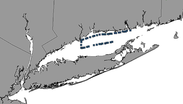
image showing the extent of the GIS layer and the distribution of benthic
foraminiferal samples collected in 1952 by F.L. Parker in Long Island Sound
Native_Data_Set_Environment:
ArcView version 3.2 shapefile format - lissound\data\chap09\parker.shp
Cross_Reference:
Citation_Information:
Originator: F. L. Parker(comp.)
Publication_Date: 19520000
Publication_Time: Unknown
Title:
Foraminiferal distribution in the Long Island Sound - Buzzards Bay area:
Series_Information:
Series_Name: Bulletin Museum Comparative Zoology
Issue_Identification: 106 (10) 428-473
Data_Quality_Information:
Attribute_Accuracy:
Attribute_Accuracy_Report:
The foraminifera species were individually identified and counted with
a binocular microscope using standard micropaleontologic procedures. This
suggest a reproducibility of less than 1 standard deviation.
Logical_Consistency_Report:
No additional checks for topological consistency were performed on this
data set.
Completeness_Report: none
Positional_Accuracy:
Horizontal_Positional_Accuracy:
Horizontal_Positional_Accuracy_Report:
Ship navigation was by radar and line of sight (sextant) and is therefore
of variable accuracy.
Vertical_Positional_Accuracy:
Vertical_Positional_Accuracy_Report: No attempt was made to correct
depths for tides..
Vertical_Positional_Accuracy_Explanation: Tidal range for Long Island
Sound
Lineage:
Source_Information:
Source_Citation:
Citation_Information:
Originator: F. L. Parker(comp.)
Publication_Date: 19520000
Publication_Time: Unknown
Title:
Foraminiferal distribution in the Long Island Sound - Buzzards Bay area
Series_Information:
Series_Name: Bulletin Museum Comparative Zoology
Issue_Identification: 106 (10) 428-473
Type_of_Source_Media: paper
Source_Time_Period_of_Content:
Time_Period_Information:
Single_Date/Time:
Calendar_Date: 19520000
Source_Currentness_Reference: Ground Condition
Source_Citation_Abbreviation: Parker, 1952
Source_Contribution:
These data were digitized from a map published in Parker, 1952.
Process_Step:
Process_Description:
Sediment samples were washed on a 0.062 mm sieve to separate the foraminifera
from the silt and clay. Foraminifera were picked from the fraction retained
on the sieve and individually identified and counted with a binocular microscope
using reflected light.
Process_Date: Unknown
Process_Contact:
Contact_Information:
Contact_Organization_Primary:
Contact_Organization: Wesleyan University
Contact_Person: Ellen Thomas
Contact_Position: Professor
Contact_Address:
Address_Type: mailing and physical address
Address: Department of Earth and Environmental Sciences
The foraminifera data and navigation were entered into a flat-file database
(Excel) and inported into Mapview for graphical analysis. The files were
subsequently exported into MIDMIF files, and converted into shape files
with the Arc utility MIFSHAPE.EXE.
Attribute_Definition: Assigned unique identifier of sample.
Attribute_Definition_Source: User Defined
Attribute_Domain_Values:
Range_Domain:
Range_Domain_Minimum: 1
Range_Domain_Maximum: 45
Attribute:
Attribute_Label: Cruis
Attribute_Definition:
Name of Cruise from which sample collected. For this data layer the cruise
name is a constant value of "PARKER dat".
Attribute_Definition_Source: software computed
Attribute_Domain_Values:
Unrepresentable_Domain: Character field
Attribute:
Attribute_Label: Station_na
Attribute_Definition: Name or number of station at which sample
was collected.
Attribute_Definition_Source: User Defined
Attribute_Domain_Values:
Range_Domain:
Range_Domain_Minimum: 23
Range_Domain_Maximum: 93
Attribute:
Attribute_Label: Longitude
Attribute_Definition: Longitude, in decimal-degrees, of sample location.
Attribute_Definition_Source: User Defined
Attribute_Domain_Values:
Range_Domain:
Range_Domain_Minimum: -75.936700
Range_Domain_Maximum: -72.305000
Attribute_Units_of_Measure: decimal-degrees
Attribute:
Attribute_Label: Latitude
Attribute_Definition: Latitude, in decimal-degrees, of sample location.
Attribute_Definition_Source: User Defined
Attribute_Domain_Values:
Range_Domain:
Range_Domain_Minimum: 41.061700
Range_Domain_Maximum: 41.260000
Attribute_Units_of_Measure: decimal-degrees
Attribute:
Attribute_Label: Water_dept
Attribute_Definition:
Measured depth of water overlying sediment at sample time, in original
units.
Attribute_Definition_Source: User Defined
Attribute_Domain_Values:
Range_Domain:
Range_Domain_Minimum: 6.500000
Range_Domain_Maximum: 29.000000
Attribute_Units_of_Measure: meters
Attribute:
Attribute_Label: E__excavat
Attribute_Definition: Elphidium excavatum in a species of benthic
foraminifera
Attribute_Definition_Source: User Defined
Attribute_Domain_Values:
Range_Domain:
Range_Domain_Minimum: 37.0000
Range_Domain_Maximum: 98.0000
Attribute_Units_of_Measure: Perecent of total benthic foraminifera
Attribute_Measurement_Resolution: 0.1 %
Attribute:
Attribute_Label: Elph__i
Attribute_Definition: Elphidium incertum is a species of benthic
foraminifera
Attribute_Definition_Source: User Defined
Attribute_Domain_Values:
Range_Domain:
Range_Domain_Minimum: 0.000000
Range_Domain_Maximum: 31.00000
Attribute_Units_of_Measure: Percent of total fbenthic oraminifera
Attribute_Measurement_Resolution: 0.1%
Attribute:
Attribute_Label: B__frigid
Attribute_Definition: Bucella frigida is a species of benthic foraminifera.
Attribute_Definition_Source: User Defined
Attribute_Domain_Values:
Range_Domain:
Range_Domain_Minimum: 1.000000
Range_Domain_Maximum: 41.000000
Attribute_Units_of_Measure: % of total benthic foraminifera.
Attribute_Measurement_Resolution: 0.10%
Attribute:
Attribute_Label: Egg__adven
Attribute_Definition: Eggeralla advena is a species of benthic foraminifera.
Attribute_Definition_Source: User Defined
Attribute_Domain_Values:
Range_Domain:
Range_Domain_Minimum: 0.000000
Range_Domain_Maximum: 27.000000
Attribute_Units_of_Measure: Percent of the total benthic foraminifera
Attribute_Measurement_Resolution: 0.1%
Attribute:
Attribute_Label: A__beccari
Attribute_Definition: Ammonia beccarii is a species of benthic foraminifera
Attribute_Definition_Source: User Defined
Attribute_Domain_Values:
Range_Domain:
Range_Domain_Minimum: 0.000000
Range_Domain_Maximum: 4.000000
Attribute_Units_of_Measure: Percent of the total benthic foraminifera
Attribute_Measurement_Resolution: 0.1%
Attribute:
Attribute_Label: A__salsu
Attribute_Definition:
Current name is Trochamina squamata, which is a species of benthic foraminifera.
Attribute_Definition_Source: User Defined
Attribute_Domain_Values:
Range_Domain:
Range_Domain_Minimum: 0.000000
Range_Domain_Maximum: 0.500000
Attribute_Units_of_Measure: Percent of the total benthic foraminifera
Attribute_Measurement_Resolution: 0.1%
Overview_Description:
Entity_and_Attribute_Overview:
This is a point layer showing the distribution of samples
collected by F.L. Parker in 1952. Attribute information associated with
the samples provide analysis of the composition of benthic foraminiferal
assemblages in LIS.
Entity_and_Attribute_Detail_Citation:
Parker, F.L., 1952, Foraminiferal distribution in the Long Island Sound
- Buzzards Bay area: Bulletin Museum Comparative Zoology, Harvard College,
106 (10), 428-473
Resource_Description: Long Island Sound: parker.shp
Distribution_Liability:
Although this derived data set and its lineage dataset have been used
by the USGS, Connecticut Department of Environmental protection and Wesleyan
University, no warranty, expressed or implied, is made by the USGS as to
the accuracy of the data and/or related materials. The act of distribution
shall not constitute any such warranty, and no responsibility is assumed
by either the USGS, Connecticut Department of Environmental Protection
or Wesleyan University, in the use of these data or related materials.
Standard_Order_Process:
Digital_Form:
Digital_Transfer_Information:
Format_Name: ARCV
Format_Information_Content:
parker.dbf
parker.shp
parker.shx
parker.avl
parker.sbn
parker.sbx
File_Decompression_Technique: No compression applied
Transfer_Size: 15Kbytes
Digital_Transfer_Option:
Offline_Option:
Offline_Media: CD-ROM
Recording_Capacity:
Recording_Density: 650
Recording_Density_Units: Mbytes
Recording_Format: ISO 9600
Compatibility_Information:
The user must have a system with a CD-ROM capable of reading an ISO-9660
standard CD-ROM disk. To browse the information contained on this disk,
the user must also have a current version of WWW browser available.
Digital_Form:
Digital_Transfer_Information:
Format_Name: ARCV
Format_Information_Content:
The six ArcView files (parker.dbf, parker.shp, parker.shx, parker.avl,
parker.sbn, parker.sbx) comprising the F.L. Parker (1952) samples collected
in Long Island Sound.
File_Decompression_Technique: zip
Transfer_Size: 4Kbytes
Digital_Transfer_Option:
Offline_Option:
Offline_Media: CD-ROM
Recording_Capacity:
Recording_Density: 650
Recording_Density_Units: Mbytes
Recording_Format: ISO 9600
Compatibility_Information:
The user must have a system with a CD-ROM capable of reading an ISO-9660
standard CD-ROM disk. To browse the information contained on this disk,
the user must also have a current version of a WWW browser available. The
user must also have the software installed on their computer system capable
to unzip the archived file.
Fees: none
Custom_Order_Process: None
Technical_Prerequisites:
The parker layer is available in an ArcView shapefile format. The user
must have ESRI's ArcView 3.0 or greater software to read and process the
data file. In lieu of ArcView, the user may utilize another GIS application
package capable of importing the data.
Available_Time_Period:
Time_Period_Information:
Single_Date/Time:
Calendar_Date: 20001101
Metadata_Reference_Information:
Metadata_Date: 20000802
Metadata_Contact:
Contact_Information:
Contact_Person_Primary:
Contact_Person: Larry Poppe
Contact_Organization: U. S. Geological Survey
Contact_Position: geologist
Contact_Address:
Address_Type: mailing and physical address
Address: 384 Woods Hole Road
City: Woods Hole
State_or_Province: MA
Postal_Code: 02543-1598
Country: USA
Contact_Voice_Telephone: (508) 548-8700 x2314
Contact_Facsimile_Telephone: (508) 457-2310
Contact_Electronic_Mail_Address: lpoppe@usgs.gov
Metadata_Standard_Name: FGDC Content Standards for Digital Geospatial
Metadata
Metadata_Standard_Version: FGDC-STD-001-1998
Metadata_Time_Convention: Local time
Metadata_Access_Constraints: None
Metadata_Use_Constraints: None
Generated by mp
version 2.5.3 on Wed Aug 02 18:57:51 2000