Georeferenced sea-floor mapping and bottom photography in Long Island Sound
Series_Information:
Series_Name: U.S. Geological Survey Open-File Report
Issue_Identification: OFR 00-304
Publication_Information:
Publication_Place: Woods Hole Field Center
Publisher: U.S. Geological Survey
Description:
Abstract:
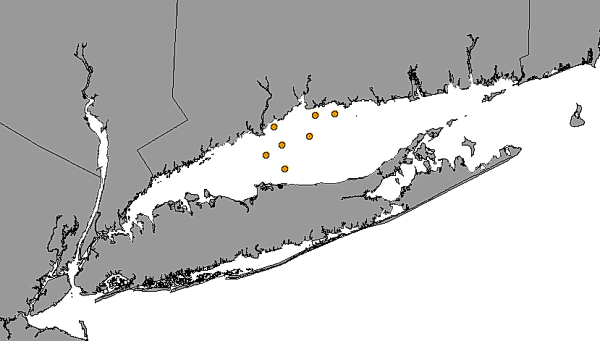
This GIS layer provides the location where samples were taken in a survey
conducted by H.L. Sanders (1956)
Purpose:
This data layer, which focuses on benthic communities, was developed as
part of a cooperative project between the University of New Haven, the
Connecticut DEP, and the U.S. Geological Survey. Benthic communities are
an integral component of the ecology of LIS. Understanding the role that
spatial heterogeneity plays in the dynamic of benthic landscapes may be
a key to developing a better understanding of the estuarine ecology and
the impacts of huuman activity. The purpose of providing this data layer
is to help establish a regional framework for developing a more extensive
GIS for benthic communities in LIS that can be used for education, research,
and environmental management.
Time_Period_of_Content:
Time_Period_Information:
Single_Date/Time:
Calendar_Date: 19560000
Currentness_Reference: Publication Date
Status:
Progress: Complete
Maintenance_and_Update_Frequency: None planned
Spatial_Domain:
Bounding_Coordinates:
West_Bounding_Coordinate: -73.0991
East_Bounding_Coordinate: -72.7566
North_Bounding_Coordinate: 41.2256
South_Bounding_Coordinate: 41.0167
Keywords:
Theme:
Theme_Keyword_Thesaurus: General
Theme_Keyword: U. S. Geological Survey
Theme_Keyword: USGS
Theme_Keyword: Coastal and Marine Geology Team
Theme_Keyword: Coastal and Marine Geology Program
Theme_Keyword: Woods Hole Field Center
Theme_Keyword: Connecticut Department of Environmental Protection
Theme_Keyword: University of New Haven
Theme_Keyword: ArcView
Theme_Keyword: arcview
Theme_Keyword: shapefile
Theme_Keyword: points
Theme_Keyword: Sanders
Theme_Keyword: oceanography
Theme_Keyword: biology
Theme_Keyword: communities
Place:
Place_Keyword_Thesaurus: General
Place_Keyword: Long Island Sound
Place_Keyword: estuary
Place_Keyword: Connecticut
Place_Keyword: New York
Access_Constraints:
The University of New Haven and the U.S. Geological Survey must be referenced
as the originator of the data set in any future products or as research
derived from these data.
Although this derived data set and its lineage dataset have been used by
the University of New Haven and the USGS, no warranty, expressed or implied,
is made by the University of New Haven or the USGS as to the accuracy of
the data and/or related materials. The act of distribution shall not constitute
any such warranty, and no responsibility is assumed by the University of
New Haven or the USGS in the use of the data or related materials.
Source_Contribution: Describes benthic communities in Long Island
Sound
Process_Step:
Process_Description:
Sediment samples were collected by grab sampler and were wet sieved to
remove the mud fraction. Coarse fractions were stored in formalin until
individual species specimens could be identified and counted with a binocular
microscope under reflected light.
Source_Used_Citation_Abbreviation: Sander's station locations
Carried over from the ArcInfo attribute SANDRS56#. SANDRS56# is an ArcInfo
internal control parameter and has no applicable relevance to the use of
the data.
Attribute_Definition_Source: software computed
Attribute_Domain_Values:
Range_Domain:
Range_Domain_Minimum: 1
Range_Domain_Maximum: 7
Attribute:
Attribute_Label: Sandrs56_id
Attribute_Definition:
Carried over from the ArcInfo attribute SANDRS56-ID. SANDRS56-ID is an
ArcInfo internal control parameter and has no applicable relevance to the
use of the data.
Attribute_Definition_Source: software computed
Attribute_Domain_Values:
Range_Domain:
Range_Domain_Minimum: 1
Range_Domain_Maximum: 7
Overview_Description:
Entity_and_Attribute_Overview:
The original studies were conducted to describe benthic communities; the
corresponding data layer is presented to show where information is available.
Although this derived data set and its lineage dataset have been used by
University of New Haven (UNH) and the U.S. Geological Survey (USGS), no
warranty, expressed or implied, is made by either UNH or the USGS as to
the accuracy of the data and/or related materials. The act of distribution
shall not constitute any such warranty, and no responsibility is assumed
by either UNH or the USGS in the use of these data or related materials.
Standard_Order_Process:
Digital_Form:
Digital_Transfer_Information:
Format_Name: ARCV
Format_Information_Content:
sanders.dbf
sanders.shp
sanders.shx
sanders.avl
sanders.sbn
sanders.sbx
File_Decompression_Technique: No compression applied
Transfer_Size: 3Kbytes
Digital_Transfer_Option:
Offline_Option:
Offline_Media: CD-ROM
Recording_Capacity:
Recording_Density: 650
Recording_Density_Units: Mbytes
Recording_Format: ISO 9600
Compatibility_Information:
The user must have a system with a CD-ROM capable of reading an ISO-9660
standard CD-ROM disk. To browse the information contained on this disk,
the user must also have a current version of a WWW browser available.
Digital_Form:
Digital_Transfer_Information:
Format_Name: ARCV
Format_Information_Content:
The six ArcView files (sanders.dbf, sanders.shp, sanders.shx, sanders.avl,
sanders.sbn, sanders.sbx) comprising a GIS layer showing the location of
the Sanders (1956) samples.
File_Decompression_Technique: zip
Transfer_Size: 2Kbytes
Digital_Transfer_Option:
Offline_Option:
Offline_Media: CD-ROM
Recording_Capacity:
Recording_Density: 650
Recording_Density_Units: Mbytes
Recording_Format: ISO 9600
Compatibility_Information:
The user must have a system with a CD-ROM capable of reading an ISO-9660
standard CD-ROM disk. To browse the information contained on this disk,
the user must also have a current version of a WWW browser available. The
user must also have the software installed on their computer system capable
to unzip the archived file.
Fees: none
Custom_Order_Process: None
Technical_Prerequisites:
This GIS layer is available in ArcView shape-file format. Users must have
ArcView 3.0 or later, or another GIS application capable of importing the
data.
Available_Time_Period:
Time_Period_Information:
Single_Date/Time:
Calendar_Date: 20000000
Metadata_Reference_Information:
Metadata_Date: 20000805
Metadata_Contact:
Contact_Information:
Contact_Person_Primary:
Contact_Person: Larry Poppe
Contact_Organization: U.S. Geological Survey
Contact_Position: geologist
Contact_Address:
Address_Type: mailing address
Address: 384 Woods Hole Road
City: Woods Hole
State_or_Province: MA
Postal_Code: 02543
Country: USA
Contact_Voice_Telephone: (508) 548-8700 x2314
Contact_Facsimile_Telephone: (508) 457-2310
Contact_Electronic_Mail_Address: lpoppe@usgs.gov
Metadata_Standard_Name: FGDC Content Standards for Digital Geospatial
Metadata
Metadata_Standard_Version: FGDC-STD-001-1998
Metadata_Time_Convention: Local time
Metadata_Access_Constraints: None
Metadata_Use_Constraints: None
Generated by mp
version 2.5.3 on Sun Aug 06 15:20:08 2000