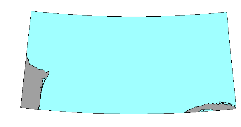
Mexico and Cuba land mass for Gulf of Mexico ArcView project view
Larger_Work_Citation:
Citation_Information:
Originator: Defense Mapping Agency(comp.)
Publication_Date: Unknown
Publication_Time: Unknown
Title: World Data Bank II
Geospatial_Data_Presentation_Form: map
Description:
Abstract:
This GIS overlay is a component of the U. S Geological Survey, Woods Hole
Field Center's, Gulf of Mexico ArcView GIS database. The Gulf of Mexico
GIS database is intended to organize and display USGS held data and provide
on-line (WWW) access to the data and/or metadata.
Purpose:
This ArcView GIS layer is intended as a backdrop to the Gulf of Mexico
area map. It contains the South America body of land that falls within
the database bounds.
Browse_Graphic_File_Type: MexicoCuba land mass for Gulf of Mexico
ArcView project area
Native_Data_Set_Environment: ESRI Shapefile format
Data_Quality_Information:
Logical_Consistency_Report:
No additional checks for topological consistency were performed on this
data set.
Completeness_Report: none
Lineage:
Source_Information:
Source_Citation:
Citation_Information:
Originator: U. S. Defense Mapping Agency(comp.)
Publication_Date: Unknown
Publication_Time: Unknown
Title: World Data Bank II coastline
Edition: U. S. Defense Mapping Agency
Geospatial_Data_Presentation_Form: map
Source_Scale_Denominator: 2000000
Type_of_Source_Media: magnetic tape
Source_Time_Period_of_Content:
Time_Period_Information:
Single_Date/Time:
Calendar_Date: 19981006
Source_Currentness_Reference: Publication Date
Source_Citation_Abbreviation: WDBII
Source_Contribution:
The World Data Bank II vector information was used to generate the US/Mexico
international border and the coastlines of Mexico and Cuba.
Process_Step:
Process_Description:
The World Data Bank II coastline information has been stored in a format
for use with the U.S. Geological Survey's Mapgen prorgam. The vector latitude/longitude
coordinates were extracted from from the MAPGEN file with the area coordinates
of -99.5, 31.5 and -79.5, 22.5. This retrieval was done for the South America
coastline (sacoast.txt) and the US/Mexico international boundary (sabdy.txt).
The two separate ASCII files that contained lon/lat values for the vector
segments were created and combined during various processing steps to create
complete polygons for the South American countries.
The ASCII files generated from the MAPGEN coast files were imported to
PCI Remote Sensing Software's Imageworks program. Each file was imported
to a separate segment. Polygons that should have been closed were checked,
and if not closed, they were closed during the Imageworks vector editting
session. Each of the countries were editted so as to create a complete
polygon for that individual country. This was done by combining the country
coastline (sacoast.txt) and the US/Mexico border (sabdy.txt). Additional
lines were drawn at the edge of the database to completely cose some polygons.
The newly editted vectors was then saved in the PCIdatabase file and exported
as ARC export (.e00) files with the nodes recorded as latitude/longitude
in decimal degrees.
The ARC export file, sabody.e00, was imported to ARC as coverage sabody.
One polygon that formed an inland lake was removed from the coverage as
all the lakes for the area will be held in a separate coverage. No clean
was necessary and the polygon was built directly from the imported file.
The ArcView shapefile, sabody, was brought into ArcView for some final
editting. Polygons that represented inland waterways were deleted from
the coverage as to make polygon "donuts". The sabody attributes table was
modified to add one field, country. The table was editted to identify the
polygons as to their country affiliation. This is the final file created
for this overlay/theme.
SDTS_Point_and_Vector_Object_Type: GT-polygon composed of chains
Point_and_Vector_Object_Count: 38
Spatial_Reference_Information:
Horizontal_Coordinate_System_Definition:
Geographic:
Latitude_Resolution: .005
Longitude_Resolution: .005
Geographic_Coordinate_Units: Decimal degrees
Geodetic_Model:
Horizontal_Datum_Name: North American Datum of 1927
Ellipsoid_Name: Clarke 1866
Semi-major_Axis: 6378206.4
Denominator_of_Flattening_Ratio: 294.98
Entity_and_Attribute_Information:
Detailed_Description:
Entity_Type:
Entity_Type_Label: sabody.dbf
Entity_Type_Definition: Shapefile Attribute Table
Entity_Type_Definition_Source: None
Attribute:
Attribute_Label: Area
Attribute_Definition:
Total computed area of polygon shapefile element. The Area is carried over
from the AREA attribute in ArcInfo. AREA is an ArcInfo internal control
parameter and has no relevance to the use of the data.
Attribute_Definition_Source: Software computed
Attribute_Domain_Values:
Range_Domain:
Range_Domain_Minimum: 0.000
Range_Domain_Maximum: 7.261
Attribute:
Attribute_Label: Perimeter
Attribute_Definition:
Perimeter of polygon. The Perimeter is carried over from the PERIMETER
attribute in ArcInfo. PERIMETER is an ArcInfo internal control parameter
and has no applicable relevance to the use of the data.
Attribute_Definition_Source: Software computed
Attribute_Domain_Values:
Range_Domain:
Range_Domain_Minimum: 0.072
Range_Domain_Maximum: 26.606
Attribute:
Attribute_Label: Sabody_
Attribute_Definition:
Value from ARC assigned SABODY# from sabody.pat table. Generally has no
meaning in ArcView shapefile.
Attribute_Definition_Source: User Defined
Attribute_Domain_Values:
Range_Domain:
Range_Domain_Minimum: 2
Range_Domain_Maximum: 35
Attribute:
Attribute_Label: Sabody_id
Attribute_Definition:
Value from ARC assigned SABODY-ID from sabody.pat table. Generally has
no meaning in ArcView shapefile.
Attribute_Definition_Source: User Defined
Attribute_Domain_Values:
Range_Domain:
Range_Domain_Minimum: 1
Range_Domain_Maximum: 34
Attribute:
Attribute_Label: Country
Attribute_Definition: country name assigned to polygon
Resource_Description: Gulf of Mexico GIS database: sabody.shp
Distribution_Liability:
Although this derived data set and their lineage datasets have been used
by the USGS, no warranty, expressed or implied, is made by the USGS as
to the accuracy of the data and/or related materials. The act of distribution
shall not constitute any such warranty, and no responsibility is assumed
by the USGS in the use of these data or related materials.
Standard_Order_Process:
Digital_Form:
Digital_Transfer_Information:
Format_Name: ARCV
Format_Information_Content:
sabody.shp
sabody.dbf
sabody.shx
File_Decompression_Technique: No compression applied
Transfer_Size: 85Kb
Digital_Transfer_Option:
Offline_Option:
Offline_Media: CD-ROM
Recording_Capacity:
Recording_Density: 650
Recording_Density_Units: Mbytes
Recording_Format: ISO 9600
Compatibility_Information:
The user must have a system with a CD-ROM capable of reading an ISO-9660
standard CD-ROM disk.
Digital_Form:
Digital_Transfer_Information:
Format_Name: ARCV
Format_Information_Content:
The three ArcView shapefiles (sabody.dbf, sabody.shp, sabody.shx) comprising
the MexicoCuba (sabody) coverage.
File_Decompression_Technique: zip
Transfer_Size: 31Kb
Digital_Transfer_Option:
Offline_Option:
Offline_Media: CD-ROM
Recording_Capacity:
Recording_Density: 650
Recording_Density_Units: Mbytes
Recording_Format: ISO 9600
Compatibility_Information:
The user must have a system with a CD-ROM capable of reading an ISO-9660
standard CD-ROM disk. The user must also have software installed on their
computer system capable to unzip the archived file.
Fees: none
Technical_Prerequisites:
The MexicoCuba land body (sabody) is available in an ArcView shapefile
format. The user must have ESRI's ArcView 3.0 or greater software to read
and process the data file. In lieu of Arcview, the user may utilize another
GIS application package capable of importing the data.
Access to the data and information contained on this CD-ROM was developed
using the HyperText Markup Language (HTML) utilized by the World Wide Web
(WWW) project. Development of the CD-ROM documentation and user interface
in HTML allows a user to access the information by using a variety of WWW
information browsers to facilitate browsing and locating information and
data.
This CD-ROM should be readable by a variety of operating systems including
Windows 95/98/NT, Macintosh and UNIX.