Title: 2degree graticule for Gulf of Mexico project area
Publication_Information:
Publication_Place: Woods Hole Field Center
Publisher: U.S. Geological Survey
Description:
Abstract:
Contains a 2degree graticule for the Gulf of Mexico region. This layer
may be displayed over the ArcView Gulf of Mexico project view to display
a 2 degree grid for the area.
Purpose:
This GIS overlay is a component of the U. S Geological Survey, Woods Hole
Field Center's, Gulf of Mexico ArcView GIS database. The Gulf of Mexico
GIS database is intended to organize and display USGS held data and provide
on-line (WWW) access to the data and/or metadata.
Time_Period_of_Content:
Time_Period_Information:
Single_Date/Time:
Calendar_Date: 19990401
Time_of_Day: 06550000
Currentness_Reference: Publication Date
Status:
Progress: Complete
Maintenance_and_Update_Frequency: None planned
Spatial_Domain:
Bounding_Coordinates:
West_Bounding_Coordinate: -99.4999
East_Bounding_Coordinate: -79.5002
North_Bounding_Coordinate: 31.0998
South_Bounding_Coordinate: 22.4995
Keywords:
Theme:
Theme_Keyword_Thesaurus: General
Theme_Keyword: U.S. Geological Survey
Theme_Keyword: Coastal and Marine Geology Program
Theme_Keyword: Woods Hole Field Center
Theme_Keyword: Gulf of Mexico Database
Theme_Keyword: ArcView
Theme_Keyword: Geographic Information Systems
Theme_Keyword: polyline
Theme_Keyword: shapefiles
Theme_Keyword: graticule
Theme_Keyword: 2 degree graticules
Place:
Place_Keyword_Thesaurus: General
Place_Keyword: Gulf of Mexico
Access_Constraints: None
Use_Constraints:
Although this derived data set and it's lineage dataset have been used
by the USGS, no warranty, expressed or implied, is made by the USGS as
to the accuracy of the data and/or related materials. The act of distribution
shall not constitute any such warranty, and no responsibility is assumed
by the USGS in the use of these data or related materials.
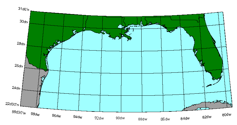
Browse_Graphic_File_Description: 2 degree graticule shown over project
area background with US Gulf Coast states, Mexico and Cuba
Browse_Graphic_File_Type: GIF
Native_Data_Set_Environment: ESRI Shapefile format
Data_Quality_Information:
Logical_Consistency_Report:
No additional checks for topological consistency were performed on this
data set.
Completeness_Report: none
Lineage:
Source_Information:
Source_Citation:
Citation_Information:
Originator: Valerie Paskevich(comp.)
Publication_Date: 19990401
Publication_Time: 06550000
Title: coast.pix
Geospatial_Data_Presentation_Form: map
Type_of_Source_Media: computer program
Source_Time_Period_of_Content:
Time_Period_Information:
Single_Date/Time:
Calendar_Date: 19990401
Time_of_Day: 06550000
Source_Currentness_Reference: data created
Source_Citation_Abbreviation: coast.pix
Source_Contribution:
A base file, coast.pix, that included the extents of the Gulf of Mexico
project area was defined using the PCI Remote Sensing software. This file
was georeferenced and was used to develop and quickly edit several different
vector data layers for the area.
Process_Step:
Process_Description:
PCI program GRATIC was used to create a lat/lon graticule at the user specified
interval of 2 degrees for the file coast.pix. The created graticule was
saved in a vector segment in the PCI database file.
Resource_Description: Gulf of Mexico IMS 2degree graticule
Distribution_Liability:
Although this derived data set has been used by the USGS, no warranty,
expressed or implied, is made by the USGS as to the accuracy of the data
and/or related materials. The act of distribution shall not constitute
any such warranty, and no responsibility is assumed by the USGS in the
use of these data or related materials.
Standard_Order_Process:
Digital_Form:
Digital_Transfer_Information:
Format_Name: ARCV
Format_Information_Content:
gratic.avl
gratic.dbf
gratic.shp
gratic.shx
File_Decompression_Technique: No compression applied
Transfer_Size: 2,553kb
Digital_Transfer_Option:
Offline_Option:
Offline_Media: CD-ROM
Recording_Capacity:
Recording_Density: 650
Recording_Density_Units: Mbytes
Recording_Format: ISO 9600
Compatibility_Information:
The user must have a system with a CD-ROM capable of reading an ISO-9660
standard CD-ROM disk.
Digital_Form:
Digital_Transfer_Information:
Format_Name: ARCV
Format_Information_Content:
The four ArcView shapefiles (gratic.avl, gratic.dbf gratic.shp and gratic.shx)
comprising the 2 degree graticule for the Gulf of Mexico project area.
File_Decompression_Technique: zip
Transfer_Size: 1689Kbytes
Digital_Transfer_Option:
Offline_Option:
Offline_Media: CD-ROM
Recording_Capacity:
Recording_Density: 650
Recording_Density_Units: Mbytes
Recording_Format: ISO 9600
Compatibility_Information:
The user must have a system with a CD-ROM capable of reading an ISO-9660
standard CD-ROM disk. The user must also have software installed on their
computer system capable to unzip the archived file.
Fees: none
Technical_Prerequisites:
The Gulf of Mexico 2 degree graticule (gratic) is available in an ArcView
shapefile format. The user must have ESRI's ArcView 3.0 or greater software
to read and process the data file. In lieu of Arcview, the user may utilize
another GIS application package capable of importing the data.
Access to the data and information contained on this CD-ROM was developed
using the HyperText Markup Language (HTML) utilized by the World Wide Web
(WWW) project. Development of the CD-ROM documentation and user interface
in HTML allows a user to access the information by using a variety of WWW
information browsers to facilitate browsing and locating information and
data.
This CD-ROM should be readable by a variety of operating systems including
Windows 95/98/NT, Macintosh and UNIX.