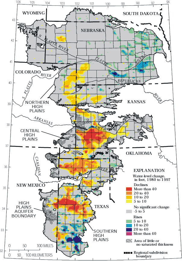
Digital map of water-level changes in the High Plains aquifer in parts of Colorado, Kansas, Nebraska, New Mexico, Oklahoma, South Dakota, Texas, and Wyoming, 1980 to 1997
Open-File Report 00-96
By Brian C. Fischer, Keith M. Kollasch and Virginia L. McGuire
Water-level change figure - Water-level changes in the High Plains aquifer, 1980 to 1997
Web Report - This map is published in the web report "Water-level changes, 1980 to 1997, and saturated thickness, 1996-97, in the High Plains aquifer" and USGS Fact Sheet 124-99, "Water-level changes, 1980 to 1997, and saturated thickness, 1996-97, in the High Plains aquifer".
| AccessibilityFOIAPrivacyPolicies and Notices | |
 |
|