
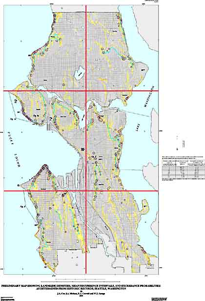
Plate 1. Preliminary map showing landslide densities, mean recurrance intervals, and exceedance probabilities as determined from historic records, Seattle, Washington.
The map has been broken into 6 pieces for viewing in detail on the web. The compressed size of the pieces range from 73KB to 140KB. Click on a piece to see the detail.
Click to get a printable version of the map (to scale) as an encapsulated postscript (EPS) file (19MB). or a portable document format (PDF) file (19MB).
| AccessibilityFOIAPrivacyPolicies and Notices | |
| |
|