
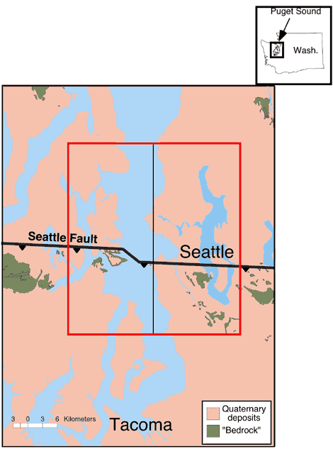
Figure 1. Generalized geologic map of the Puget Lowland showing the approximate surface projection of the Seattle fault (from Johnson et al. [1999]) and area of model simulation. Seattle fault shown as heavy black line. Vertical black line is location of highlighted part of cross-section in Figure 2. Region of finite-difference simulation shown in red box and is also area of map views in Figures 4 and 5.
| AccessibilityFOIAPrivacyPolicies and Notices | |
| |
|