
Open-File Report 00-300
By Brian C. Fischer, Keith M. Kollasch and Virginia L. McGuire
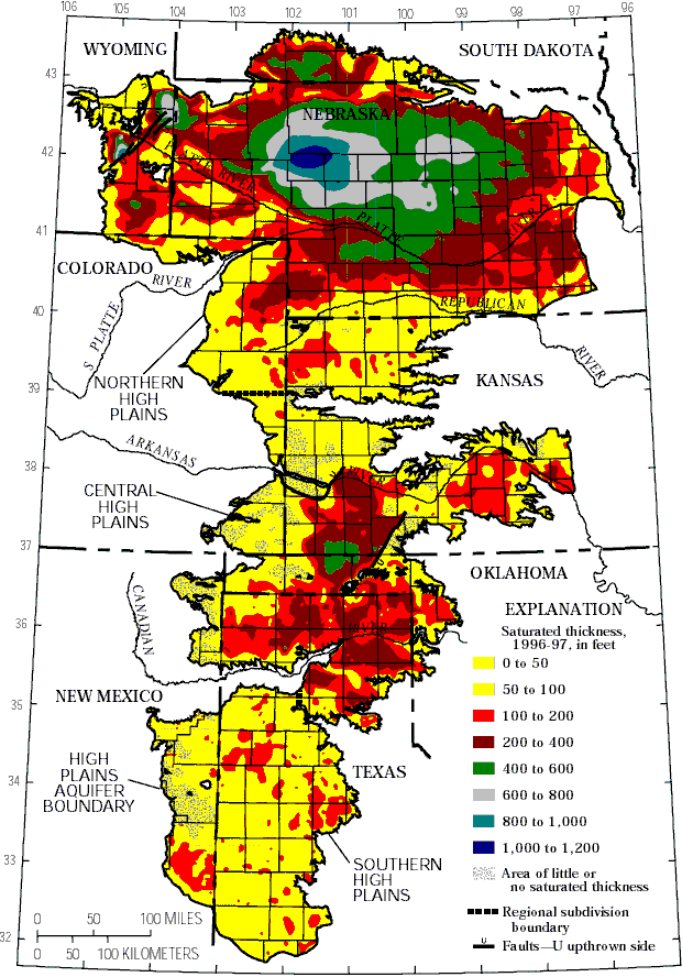
Saturated Thickness figure - Saturated thickness of the High Plains aquifer, 1996-97.
Web Report - This map is published in the web report "Water-level changes, 1980 to 1997, and saturated thickness, 1996-97, in the High Plains aquifer" and USGS Fact Sheet 124-99, "Water-level changes, 1980 to 1997, and saturated thickness, 1996-97, in the High Plains aquifer".
| AccessibilityFOIAPrivacyPolicies and Notices | |
 |
|