
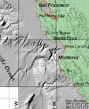
Shaded relief images at several scales and resolutions in TIFF format have been generated from elevation grids (<http://geopubs.wr.usgs.gov/open-file/of01-179>) of the Monterey Bay National Marine Sanctuary.
This is one of a collection of digital files of a geographic information system of spatially referenced data related to the USGS Coastal and Marine Geology Program "Monterey Bay National Marine Sanctuary Project" <http://walrus.wr.usgs.gov/mbms>. The data were collected and analyzed between 1994 and 2000.
Wong, Florence L. , 2001, Shaded relief images of the Monterey Bay National Marine Sanctuary,California:.This is part of the following larger work.Online Links:
Wong, F.L., and Eittreim, S.E., 2001, Continental Shelf GIS for the Monterey Bay National Marine Sanctuary: U.S. Geological Survey Open-File Report 01-179, U.S. Geological Survey, Menlo Park, CA.Online Links:
This is a Raster data set. It contains the following raster data types:
Planar coordinates are encoded using coordinate pair
Abscissae (x-coordinates) are specified to the nearest 153.5527088818
Ordinates (y-coordinates) are specified to the nearest 153.5527088818
Planar coordinates are specified in meters
The horizontal datum used is nad83.
The ellipsoid used is GRS1980.
The semi-major axis of the ellipsoid used is 6378137.0.
The flattening of the ellipsoid used is 1/298.257.
The geographic extent of each image (in degrees) is
   GRID            XMIN      YMIN        XMAX     YMAX
BATTOPSD.TIF:  -122.45742, 36.16417, -121.66685, 37.16997
CCALSHD.TIF:   -123.53043, 35.47100, -120.93105, 38.02927
MNT95NSD.TIF:  -121.93783, 36.69220, -121.81536, 36.77865
MNT95SSD.TIF:  -121.99783, 36.60334, -121.81533, 36.69667
MTCANSD.TIF:   -122.03176, 36.74115, -121.78947, 36.88549
MTSHLFSD.TIF:  -122.03229, 36.56534, -121.87569, 36.75134
SGFSD.TIF:     -122.03259, 36.36070, -121.91377, 36.57095
SURSD.TIF:     -122.08845, 36.21525, -121.91450, 36.37142
The geographic extent, columns and rows (samples and lines), and pixel size of each image (in UTM Zone 10 meters) is
   GRID        XMIN     YMIN    XMAX     YMAX   NCOLS NROWS PIXEL
BATTOPSD.TIF  548796  4002959  618366  4113869  2319   3697  30
CCALSHD.TIF   453448  3927119  681627  4209195  1486   1837 153
MNT95NSD.TIF  594887  4061379  605712  4070844  2165   1893   5
MNT95SSD.TIF  589629  4051522  605829  4061692  3240   2034   5
MTCANSD.TIF   586439  4066838  607874  4082608  4287   3154   5
MTSHLFSD.TIF  586589  4047241  600364  4067726  2755   4097   5
SGFSD.TIF     586791  4024501  597191  4047716  2080   4643   5
SURSD.TIF     581931  4008367  597376  4025532  3089   3433   5
The shaded relief images have the following attributes:
Image Format :              TIFF
Image Type :           GRAYSCALE
Image Colormap :           FALSE
Image Compressed :         FALSE
Image Rotated :            FALSE
Image Depth =                  8
Image Bands =                  1
Florence L. Wong
United States Geological Survey (USGS)
Geologist, GIS Coordinator
USGS, MailStop 999, 345 Middlefield Road
Menlo Park, CA 94025-3561
USA
(650) 329-5327 (voice)
(650) 329-5190 (FAX)
fwong@usgs.gov
These data are intended for science researchers, students, policy makers, and the general public. The data can be used with geographic information systems (GIS) software to display geologic and oceanographic information about the shallower areas of the Monterey Bay National Marine Sanctuary.
Not available.
Not available.
Complete.
Not applicable for raster data.
Are there legal restrictions on access or use of the data?
- Access_Constraints:
- None
- Use_Constraints:
- Please recognize the U.S. Geological Survey (USGS) as the source of this information.
Although these data have been used by the U.S. Geological Survey, U.S. Department of the Interior, no warranty expressed or implied is made by the U.S. Geological Survey as to the accuracy of the data.
The act of distribution shall not constitute any such warranty, and no responsibility is assumed by the U.S. Geological Survey in the use of this data, software, or related materials.
This information is not intended for navigational purposes.
Any use of trade, firm, or product names is for descriptive purposes only and does not imply endorsement by the U.S. Government.
United States Geological Survey (USGS)
c/o Florence L. Wong
Geologist, GIS Coordinator
USGS, MailStop 999, 345 Middlefield Road
Menlo Park, CA 94025-3561
USA
(650) 329-5327 (voice)
(650) 329-5190 (FAX)
fwong@usgs.gov
USGS Open-File Report 01-179
Please recognize the U.S. Geological Survey (USGS) as the source of this information.Although these data have been used by the U.S. Geological Survey, U.S. Department of the Interior, no warranty expressed or implied is made by the U.S. Geological Survey as to the accuracy of the data.
Any use of trade, product, or firm names is for descriptive purposes only and does not imply endorsement by the U.S. Government.
The act of distribution shall not constitute any such warranty, and no responsibility is assumed by the U.S. Geological Survey in the use of this data, software, or related materials.
| Data format: | shaded relief TIFF images in format ArcInfo (version 8.0.2) Size: 65 megabytes |
|---|---|
| Network links: |
<http://geopubs.wr.usgs.gov/open-file/of01-179/> |
United States Geological Survey (USGS)
c/o Florence L. Wong
Geologist, GIS Coordinator
USGS, MailStop 999, 345 Middlefield Road
Menlo Park, CA 94025-3561
USA
(650) 329-5327 (voice)
(650) 329-5190 (FAX)
fwong@usgs.gov