Open-File Report 01-350
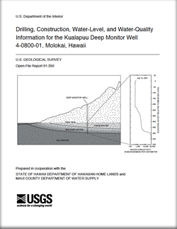
A monitor well was completed in January 2001 by the U.S. Geological Survey in the Kuala-puu area of central Molokai, Hawaii that allows for monitoring the thicknesses of the freshwater body and the upper part of the underlying freshwater-saltwater transition zone. The well was drilled in cooperation with the State Department of Hawaiian Home Lands and the Maui County Department of Water Supply, and is located near the area that supplies much of the drinking water on Molokai. The well is at a ground-surface elevation of about 982 feet and penetrated a 1,585-foot section of soil and volcanic rock to a depth of 603 feet below sea level. Prior to casing, a cave-in caused the bottom 55 feet of the well to be filled with rocks originating from a zone above. Thus, the final well depth reported by the driller was 1,530 feet. Measured water levels in the well during the period from February 1 to July 13, 2001 range from 8.68 to 9.05 feet above sea level. The most recent available water-conductivity profile from July 13, 2001 indicates that the lowest salinity water in the well is in the upper zone from the water table to a depth of about 220 feet below sea level. Below this upper zone, water salinity increases with depth. The water-temperature profile from July 13, 2001 indicates that the lowest temperature water (20.2 degrees Celsius) in the well is located in the upper zone from the water table to a depth of about 200 feet below sea level. Water temperature increases to 24.5 degrees Celsius near the bottom of the measured profile, 507 feet below sea level. |
For additional information contact: Part or all of this report is presented in Portable Document Format (PDF); the latest version of Adobe Reader or similar software is required to view it. Download the latest version of Adobe Reader, free of charge. |
Oki, D.S., Bauer, G.R., 2001, Drilling, construction, water-level, and water-quality information for the Kualapuu Deep Monitor Well 4-0800-01, Molokai, Hawaii: U.S. Geological Survey Open-File Report 01-350, 19 p.
Abstract
Introduction
Drilling and Well Construction
Geologic Log
Water-Level Information
Water-Conductivity and Water-Temperature Profiles
Summary and Conclusions
References Cited

![]() U.S. Department of the Interior |
U.S. Geological Survey
U.S. Department of the Interior |
U.S. Geological Survey
URL: http://pubsdata.usgs.gov/pubs/of/2001/350/index.html
Page Contact Information: GS Pubs Web Contact
Page Last Modified: Wednesday, 07-Dec-2016 18:56:22 EST
