Resistivity was also measured on the ground using a Geonics EM-16R. Unlike the magnetic susceptibility measurements, the resistivity measurements average a considerable volume of material (about a 100 meter hemisphere). The results thus agree much better with the airborne data.
The EM 16-R uses submarine communication signals near 20,000 Hz (Very Low Frequencies, or VLF) that propagate along the earth/ionosphere interface and refract into the ground. A measurement of the magnetic and electric fields at the surface allow us to measure both resitivity and phase (the phase data give us an idea of whether the ground is getting more conductive or more resistive with depth).
Like the magnetic susceptibility measurements, this work helps quantify the connection between the airborne geophysical data and the geology.
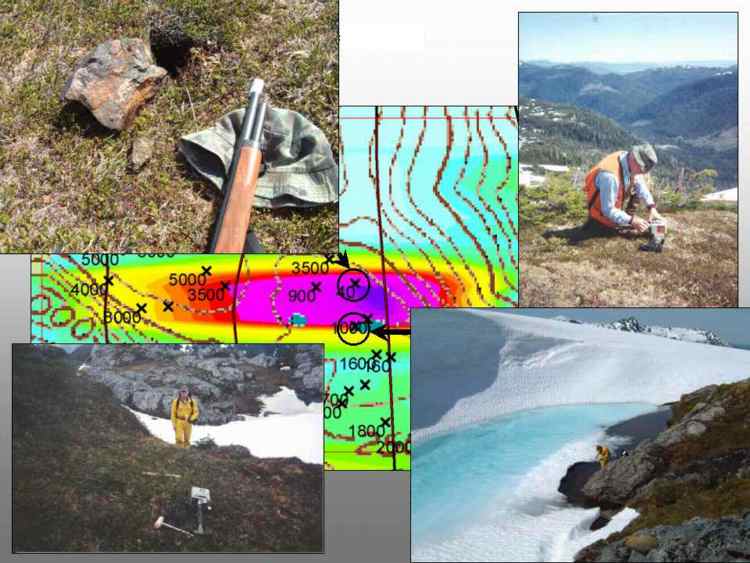
A piece of massive sulfide kicked loose from some nearby tundra is shown in the upper left photograph. To be sure that the EM response was not caused by water, the electrical conductivity of a small pond of meltwater was measured. The water was about 1 degree C and had a resistivity of about 1700 ohm-m, and so was not responsible for the anomaly.
The EM response at this location was thus most likely caused by massive sulfide mineralization.