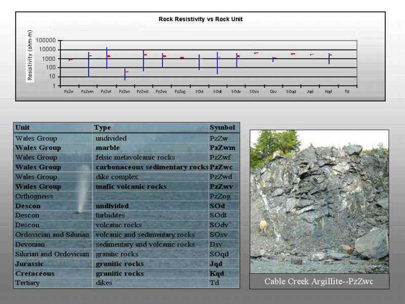

The major rock units mapped on Prince of Wales Island are subcategorized on this table.
After a season of field work, our preliminary interpretation has allowed us to correlate rock units to the physical property data. This data is critical for using the airborne geophysics to help extend the geologic mapping.
A significant effort is underway to relate these physical property measurements with known geologic units to possibly help outline the units in areas of poor rock exposure and limited mapping.
The graph shows the range and mean of resistivity grouped by the major rock units shown in the table. Note that the range of resistivities are not terribly different from one rock unit to the next. The carbonaceous unit stands out however. Also the spatial variability of these data are lost in this figure, so a better distinction between units may be more evident in a map presentation.
Note that there are a different number of samples in each category.
The photo at right shows a typical outcrop of the carbonaceous unit (Photo taken by Jeff Wynn at station RT30 east of Cable Creek).