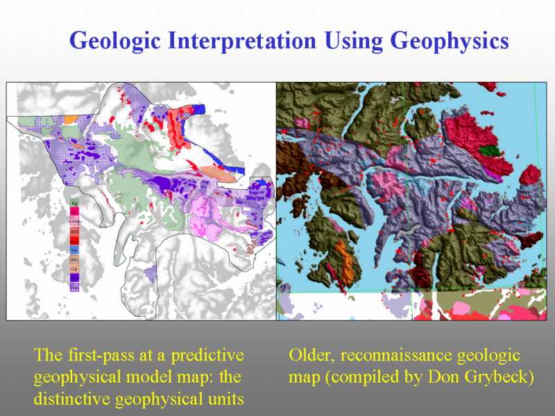

Our goal is to improve our understanding of the regional geologic picture on POW. Using the physical property data and the airborne geophysics will help improve the geologic map. We see here the first iteration based on our initial classification of the geophysical data by Anne McCafferty.