
U.S. Geological Survey Open-File Report 01-44
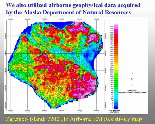
This map shows the calculated resistivities for the mid-level-depth 7,200Hz frequency of the helicopter-borne EM system for Zarembo Island.
U.S. Department of Interior, U.S. Geological Survey
URL: https://pubs.usgs.gov/openfile/of01-44/slide8.html
Contact: Jeff Wynn
Last modified 02.15.01