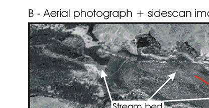
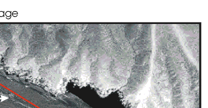
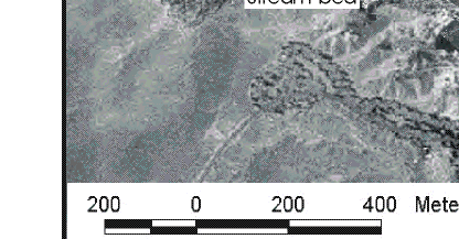
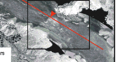
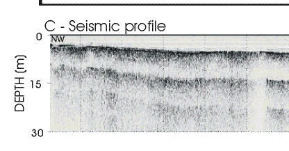
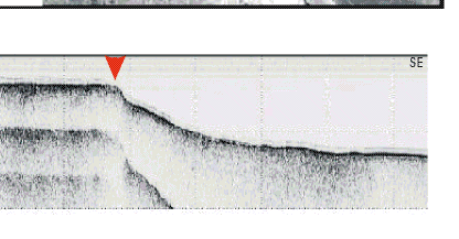
Figure 9B,C.  Sidescan sonar image superimposed on orthophotograph for reference showing the same stream bed that now is submerged. The red line marks the location of the seismic profile shown in C, and the red arrow marks the transition from delta top to delta front. Box outlines area shown in Figure 10.

Figure 9.  Orthophotograph taken in 1996 when the lake was about 4-m lower than when this survey was conducted showing a stream and subaerial part of the delta. Figure 9.  Orthophotograph taken in 1996 when the lake was about 4-m lower than when this survey was conducted showing a stream and subaerial part of the delta.